Combined excellence
Overview
Equinox is a true example of how Covelya Group technologies combine to provide ground-breaking products. Designed around the Solstice MAS from Wavefront Systems, it is commercialised by Sonardyne and features our state-of-the-art SPRINT INS and Mini-Ranger 2 USBL for state-of-the-art navigation and positioning.
The Sonardyne and Wavefront Systems payloads are all mounted on EIVA’s renowned ScanFish 3D, a steerable remotely operated towed vehicle (ROTV). EIVA’s NaviSuite Kuda user interface is used to plan, autopilot and display the gathered data in real-time.
Producing stunningly accurate pictures, it’s ideal for vessels of opportunity or unmanned surface vessels delivering hydrographic, archaeological, search, salvage, unexploded ordnance, and mine countermeasure missions.
At a glance
- Mission ready; designed to support search, classify and map (SCM) and hydrographic operations
- Survey more ground in a single pass; effective area coverage rate (ACR) of up to 1.6 km2/hr
- Along track resolution of 0.15°; best in class delivering maximum detection rates
- Co-located side-scan image and bathy improves your situational awareness
- Real-time motion compensation and positioning accuracies better than 1 m DRMS
- Automatically follows terrain and avoids obstacles
- Suitable for site survey and characterisation and high tempo MCM missions
Why Equinox is perfect for your operations
The ScanFish 3D is a trusted ROTV and, thanks to its inherent stability, the ideal platform to operate Solstice from. At a total weight of 220 kg in air, Equinox can be easily mobilised.
Unlike towed Synthetic Aperture Sonar (SAS) systems, Equinox offers you an affordable, lower-logistics alternative still capable of providing high area coverage rates. By combining leading navigation and positioning from Mini-Ranger 2 USBL and SPRINT INS, imaging data is geo-referenced with an accuracy that’s unrivalled for these types of applications at this price.
Planning a mission is easy. Using NaviSuite Kuda software, you can define your sailing route and run-lines by simply selecting the area you would like to cover. During the mission, NaviSuite Kuda continuously updates the vessel and ScanFish 3D position in real-time.
Equinox also provides real-time geo-rectified waterfall, mosaics and DTM maps and the user interface tools that enable an operator to mark and process objects, including automatic target recognition using AI.
That’s not all; ScanFish 3D can carry heavier payloads and there is room in the fibre cable to include additional payload sensors such as gap fillers. Equinox users can count on improved probability of detection and decreased probability of false alarms, improving the efficiency of your mine countermeasures, archaeological, search and salvage missions.
General
• All-in-one, rapidly mobilised solution for MCM, SCM and hydrography
• High stability platform with automatic terrain following
• NaviSuite Kuda software reduces planning times and improves processing times
• Everything supplied, including winch and 1Gbps cable
Performance
• Depth rated to 300 m
• Across track resolution 37.5 mm
• Along-track resolution 0.15°
• Geo-rectified waterfall display
• Image resolution 30 mm x 30 mm
• Co-located 200m swath side-scan and bathy
• Real-time CAD/CAC option
Design (SCANFISH)
• 1210 mm x 1858 mm x 1049 mm, 220 kg in air (73 kg in water)
• Survey speeds 3 to 6 knots
• Pitch and roll stabilised
• Automatic altitude following
Ownership
• What’s in the box: ScanFish 3D, NaviSuite Kuda software, cable and winch, Solstice MAS, Mini-Ranger 2 USBL, WSM 6+, SPRINT 500 INS, DVL
• Warranty: 1 year return to Sonardyne/EIVA service centre
• ITAR Controlled: No
• UK Export License: TBD
Equinox case studies
Capture every feature and every detail in ultra-high resolution.
Key benefits
- Mission ready; designed to support search, classify and map (SCM) and hydrographic operations
- Small and compact arrays; optimised for low-logistic AUVs and towed bodies
- Survey more ground in a single pass; 200 m-wide swath ensures high coverage rates
- Along track resolution of 0.15°; best in class delivering maximum detection rates
- Collocated side scan image and bathy improves your situational awareness
- Consumes only 18 W power: budget friendly and increases your AUV’s endurance
- Depth rated to 300 or 600 m
Solstice offers enhanced underwater detection capabilities for various missions, including mine countermeasures, archaeological, search, and salvage operations. The system provides high-performance coverage with large 200m swaths on each side, enabling efficient site characterisation without sacrificing detail. Its class-leading imagery allows you to make confident classification decisions more quickly, with the added versatility of deployment on both autonomous underwater vehicles (AUVs) and towfish platforms. By improving probability of detection and decreasing false alarms, Solstice significantly increases the overall efficiency and reliability of underwater exploration and survey missions. It is suitable for:
- Autonomous underwater vehicles (AUV)
- Site survey and characterisation
- Mine countermeasures (MCM)
- Remotely operated vehicles (ROV)
- Delivering pixel perfect imaging
Exceptional high-contrast seafloor imagery across diverse water depths
How it works
Solstice, designed by Wavefront Systems and commercialised by Sonardyne, is a world-leading side scan sonar for autonomous underwater vehicles (AUVs) and towed bodies. Its advanced technology delivers exceptional seafloor imagery through multiple aperture arrays with 32 multibeam elements, enabling superior signal-to-noise ratio performance and stunning imagery at extended ranges. The sonar’s unique back-projection beam-forming technique ensures focused imaging for every pixel, eliminating distortions caused by platform motion and guaranteeing 100% ground coverage across diverse water depths.
Designed for a wide range of marine missions including hydrographic, archaeological, search, salvage, and mine countermeasure operations, Solstice stands out through its innovative features. Its real-time array calibration dynamically recalibrates hydrophone elements multiple times per second, compensating for dynamic strains and maintaining linear element alignment. The system produces high-contrast imagery in environments ranging from 600-metre depths to very shallow littoral waters, utilising a specialised array technology that provides wide swath coverage with exceptional shadow contrast.
Solstice case studies
What is possible
Ranger 2 comes with an impressive list of features including our award-winning 6G (sixth generation) acoustic hardware platform and Sonardyne Wideband 2 digital signal architecture. It provides stable and repeatable acoustic position referencing for your ship’s DP system, including those from GE, Kongsberg, MT, Navis, Thrustmaster and Wärtsilä.
As your needs grow and become more complex, bolt-on software packs unlock additional capability and protect your investment. Take the DP pack and enable your acoustic ranging to be aided by our inertial navigation technology (DP-INS). Add the robotics pack and commanding a swarm of up to 99 AUV’s is at your fingertips.
Ranger 2 can do even more, it also supports robust two-way data telemetry, allowing you to control our range of seafloor deployed, long-endurance sensors and recover your all-important data.
Track everything, in any depth, from any vessel
Why choose it?
- Tracks multiple targets to 11 km;
- Compatible with all makes of DP system – GE, Kongsberg, MT
- System accuracy: when fully optimised it will deliver 0.04% of slant range
- Works with a global inventory of pre-deployed Sonardyne 6G hardware
- Configurations available for USV and temporary vessel installations
- Valuable features included as standard
- Bolt-on packs available for growth with your operations and ambitions
- Developed and supported by a company with over 50 years of experience in innovative underwater technology
Learn more about Ranger 2 USBL
The kit
Transceivers
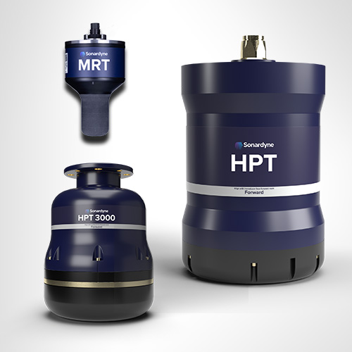
Our High Performance Transceiver (HPT), is available in a range of different designs to suit your operations whether they are in deep or shallow water or over a long layback.
HPT 5000 / 7000 are acoustic and telemetry transceivers designed for use with Ranger 2 USBL system. HPT 5000 enables targets offer wide range of water depths to be tracked; HPT 7000 is optimised for noisy DP drilling and construction vessels and in deep water.
HPT 5000 offers full hemispherical acoustic coverage so is a popular choice for tracking multiple targets (ROVs, AUVs, towfish, seafloor sensors) over a wide range of depths and elevations. The unit is also suitable for dynamic positioning reference on survey, research and offshore support vessels.
HPT 7000 is engineered for ultra-deepwater operations, tracking targets far below (rather than to the side of) a vessel, and for high vessel noise operating environments such as those typical of DP, drilling and construction where activity from thrusters is liable to cause signal interference.
If you need a solution for a vessel of opportunity, our pre-calibrated, all-in-one Gyro USBL transceiver is perfect. Lighter, smaller and just as capable, our second-generation Gyro USBL transceiver works seamlessly with Ranger 2 to track the position of your subsea targets from a USV, vessel of opportunity or from a pipelay vessel’s stinger over extreme ranges.
- All-in-one instrument; combined 6G acoustic transceiver and AHRS
- Choose between standard or ‘plus’ variants to suit your project’s specifications
- Optimises the performance of Ranger 2; eliminates lever arm offsets, pole bending and ship flexing errors
- Calibrated in-water before delivery – saving you time; install it and go to work
Transponders
The flexibility of the Ranger 2 family is further extended by our range of transponders to support a wide variety of your operations. WMT is a high-power transponder capable of operations to 7,000 m, while AvTrak 6 is our most capable acoustic vehicle instrument, combining the functions of a USBL transponder, LBL transceiver and modem for demanding applications such as AUV command and control.
Discover Ranger 2 in action
A new world of multi-robot ocean exploration
Read moreOptimising shallow water positioning for combined magnetometer and hydrographic surveys
Read moreLong-endurance AUV development with shallow water simplicity
Read morePerformance
• Up to 0.04% of slant range system accuracy
• Up 99 targets tracked, sequentially
• Up to 11,000 m tracking range (LMF)
• 1 Hz position update rate
• Supports all industry standard DP telegrams
• Supports acoustically aided INS
Acoustics
• MF frequency (20–34 kHz) or LMF (14-19.5 kHz)
• Compatible with a wide range of 6G transponders
• Supports Sonardyne Messaging Service for data exchange up to 9,000 bps
• Sonardyne Wideband 2 acoustics for reliable performance in both shallow and deep-water environments
Ownership
• ITAR Controlled: No
• Warranty: 1 year return to Sonardyne service centre
• UK Export Licence: Required
• What’s in the box: HPT 5000 / 7000 / Gyro USBL, deck cables, software, manual
Overview
• Can be used for both survey and construction phases
• Configurable to work in the LMF band enabling you to track targets to beyond 11 km
• Supports complex tracking scenarios such as structures and vehicles with multiple transponders and multiple remote offsets
Specifications table
Feature | Specification |
---|---|
Design | The most powerful USBL system on the market |
Incorporates 30 years of USBL innovation and know-how | |
Recommended for installation on large vessels and USVs | |
Global vessel track record; offshore, research, cable-lay, salvage and naval | |
Shares common platform with other Sonardyne USBLs | |
Performance | Up to 0.04% of slant range system accuracy |
Up to 99 targets tracked, simultaneously | |
Up to 11,000 m tracking range (LMF) | |
1 Hz position update rate | |
Support all industry standard DP telegrams | |
Supports acoustically-aided INS | |
Acoustics | MF frequency (20-34 kHz) or LMF (14-19.5 kHz) |
Sonardyne Wideband 2 digital acoustics for reliable performance in both shallow and deep environments | |
Supports Sonardyne Messaging Service for data exchange up to 9,000 bps | |
Compatible with a wide range of 6G transponders |
Frequently asked questions
Planning 6G beacon deployments
CASIUS calibration recommendations
What is a USBL and how does it work?
How to use Auto Discover to scan the water for unknown transponder addresses
How to format the sound speed profile for Marksman and Ranger 2
How to use HPR418BCD telegrams for DP
How to mount and extract an ISO image
How to track an underwater locator beacon
How to Compensate for Responder Latency
How to set up an SSB_LBP Telegram
Marksman/Ranger 2 DP INS indicator sequence explained
How to create an alarm to warn that the transceiver deployment pole has been left deployed
How to import waypoints into Ranger 2
How to enter Transceiver & Lodestar Offsets for Optimised USBL
Frequency management is obsolete. Here’s why.
How to set up Responder Mode
Opening a .DJF file on Sonardyne De Novo Job Viewer
How to Skip Telemetry Options in Rangers 2 and Marksman LUSBL
What should I do if my Sonardyne security dongle expires or reports a problem?
How to Capture a cef in Marksman and Ranger 2
How to download or upload files using Filezilla
Why am I getting old / incorrect data from my GyroCompatt 6+?
How to turn on a Lodestar Gyro Compatt using Ranger 2 or Fusion 2
I’m outputting a GGA from Fusion 2 / Ranger 2 to NaviPac but the position isn’t appearing in the correct location?
Health check for your acoustic system
How do I mark where my RT 6-1000 is deployed?
Will Compatt 6+ work with Ranger 2 and Marksman?
The transponder isn’t replying to interrogation or commands
Can I get USBL position updates from my AUV with Ranger 2/ Mini-Ranger 2?
How quickly can I start tracking beacons with Ranger 2?
Has anyone ever installed an echosounder and Ranger 2 USBL transceiver directly beside each other? Would this work?
Can I perform a USBL verification in shallow water without an ROV to deploy or recover the beacon?
How do USBLs work?
Which USBL Deployment Machine is most suitable for my vessel?
Advantages of using Ranger 2 for ROV tracking
When to use Depth Aiding
What’s new in Micro Ranger 2?
What to consider when mounting acoustic transducers
What acoustic address should I use for my USBL transponder
What do my CASIUS results tell me about my USBL calibration
Calibration tips for Ranger 2 USBL systems
How to align Gyro USBL to the vessel frame of reference
How to interface Ranger 2 into a 3rd party survey system
How can an uncrewed system interact with Ranger 2 software?
How can I synchronise a clock on my AUV to a GNSS reference using Ranger 2?
What is Telemetry Tracking, and why would I need it?
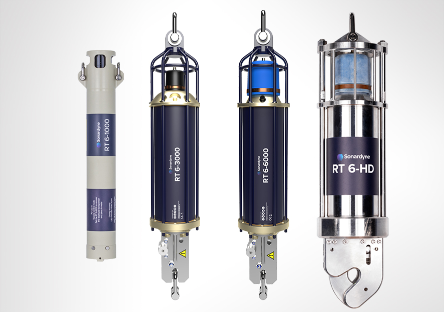
How to release an RT 6 acoustic release transponder using Ranger 2
How to set up an update rate in Ranger 2
How to set the operating range in Ranger 2
How to configure sound speed in Ranger 2
Ranger 2 – How to release an RT6 acoustic release transponder
Software and firmware
Software and control hardware
How to enter Transceiver & Lodestar Offsets for Optimised USBL
How to set up Responder Mode
Opening a .DJF file on Sonardyne De Novo Job Viewer
What’s new in Micro Ranger 2?
What do my CASIUS results tell me about my USBL calibration
How to release an RT 6 acoustic release transponder using Ranger 2
How to set up an update rate in Ranger 2
Top tips
How to Skip Telemetry Options in Rangers 2 and Marksman LUSBL
What should I do if my Sonardyne security dongle expires or reports a problem?
How to Capture a cef in Marksman and Ranger 2
How to download or upload files using Filezilla
Which USBL Deployment Machine is most suitable for my vessel?
Advantages of using Ranger 2 for ROV tracking
When to use Depth Aiding
What to consider when mounting acoustic transducers
What acoustic address should I use for my USBL transponder
Calibration tips for Ranger 2 USBL systems
How to align Gyro USBL to the vessel frame of reference
Manuals and quick start guides
Technical bulletin
Mini in size, big in performance
Small but mighty
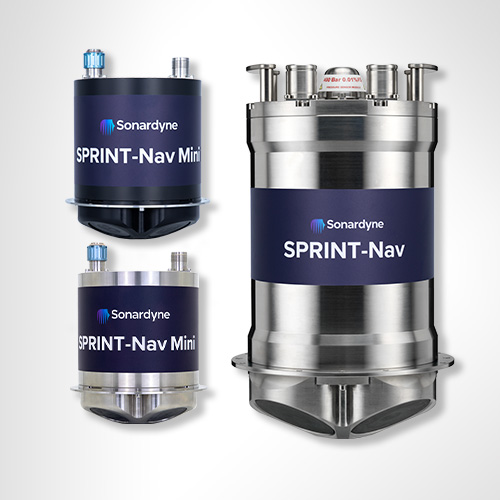
Measuring just 213 mm in height (only fractionally taller than some competing DVL-only instruments), 148 mm in diameter and weighing in at approximately 3.6 kg in air for the 300 m rated unit – or 7.1 kg for the 4,000 m depth version – for something so small, SPRINT-Nav Mini packs a big punch for all your underwater ocean robot applications.
It’s powered by the same hybrid acoustic-inertial navigation algorithm you’ll find inside our established SPRINT-Nav family. This combines the strengths of all its sensors to provide robust, precise and accurate outputs. It continues to work even in challenging environments providing a continuous stream of positions, orientation, velocities, depth and altitude at up to 200 updates per second.
Ready to go
Your SPRINT-Nav Mini arrives pre-calibrated, meaning there is no need to manoeuvre your vehicle every time the unit is mobilised. SPRINT-Nav Mini does the thinking for you, all in a single plug-and-play unit. Turn it on, give it a latitude, and away you go.
Despite its extremely small size, it’s still a true north seeking gyrocompass which won’t drift over time unlike MEMS-based systems. The output can be fed directly to your own (or a third party) user interface or vehicle control software. The simple web user interface makes setup and configuration painless. It could not be any simpler.
Need to harvest data from coastal waters or around offshore structures? Not a problem! Low power and small, SPRINT-Nav Mini is ideal for installing on all size ROVs or USVs undertaking data harvesting missions, even in GNSS-denied environments.
Conducting marine research on a restricted budget? Let us help… Because it’s lower cost than the four separate sensors it replaces, SPRINT-Nav Mini is the budget-friendly solution for your research platforms where funds need to stretch as far as possible.
Available in two depth ratings, 300 m and 4,000 m. A side-connector option is also available, depth rated for 300 m and only 183 mm high, making it ideal for tight spaces on small platforms.
SPRINT-Nav Mini at a glance
- 213 mm tall by 148 mm in diameter; the industry’s smallest all-in-one hybrid acoustic-inertial subsea navigator
- Hybrid DVL-INS synergies dramatically improve both robustness and performance compared with standalone instruments.
- Fly higher – 500 kHz DVL maintains bottom lock at up to 200 m altitude
- Replaces four separate instruments; AHRS, DVL, INS and pressure sensor – saving you cost, cabling and payload
- Easy to integrate, simple to operate, web UI for configuration
Discover more about SPRINT-Nav Mini
Straight out of the box navigational enhancement for offshore out of straightness surveys
Read moreDelivering subsea synergy in ORE inspections
Read moreMapping the future for seagrass beds in Plymouth Sound
Read moreOwnership
• What’s in the box: SPRINT-Nav Mini, mounting plate, test lead and cable tail
• Warranty: 1 year return to Sonardyne service centre
• ITAR Controlled: No
• UK Export License: TBC
Performance
• 300 m and 4,000 m depth rated options
• Provides 0.05% error for distance travelled
• Heading accuracy 0.5° secant latitude (0.1° Navigator variant)
• 0.02° Pitch/Roll accuracy
• 0.3/200 m min/max altitude
• 0.01% FS depth
• Up to 200 Hz output rate
• Better than 0.4 cm/s velocity precision (<2 m/s at 50 m altitude)
General
• Ideally suited for subsea vehicle guidance, control and navigation
• Size, weight and power optimised; perfect for all size vehicles
• Powered by our class-leading SPRINT hybrid navigation engine
• Cheaper than the four separate sensors it replaces
• Gyrocompass simplicity with hybrid acoustic-inertial navigation performance
Design
• 213 x 148 mm, 3.6 kg weight in air (300 m version), 7.1 kg (4000 m version)
• Acetal Copolymer (300 m) or Titanium (4000 m) housing construction
• Mounting plate, choice of top or bottom mounting location
• 14 pin and 7 pin Size A CRE connectors. Custom connectors on request
• Side-connector option
• User friendly web UI makes it easy to integrate and simple to operate
Specifications
Feature | SPRINT-Nav Mini | |
---|---|---|
DVL Aided | Typical Survey | 0.05% |
Distance from Origin | 0.30% | |
Altitude Min/Max | 0.3/200 m | |
USBL & DVL Aided | Precision Improvement | Up to 5x better |
Heading (Secant Latitude) with GNSS or USBL, and DVL | 0.10° | |
Heading (Secant Latitude) with GNSS or USBL or DVL | 0.15° | |
Roll and Pitch | 0.02° | |
Angular Rate Range | ±450°/s | |
Velocity Precision (<2 m/s at 50 m Altitude) | <0.4 cm/s | |
Depth accuracy | 0.01% FS | |
ADCP | Profiling range | 0.4–100 m |
Velocity Range & RMS (along beam) | Up to ±6.7 m/s ±0.4% of measured value | |
Maximum number of Cells | 255 | |
Max Ping rate | 1 Hz | |
Power Requirements | 24 V dc, 10 W | |
Data Storage | 32 GB internal memory | |
Serial Ports/Protocol | 3x RS232 | |
Other Ports | Ethernet, UDP/TCP, WebUI, 2 x trigger inputs (1PPS/DVL trigger) | |
Mechanical Construction | 300 m | POM-C |
4,000 m | Titanium | |
Dimensions (Diameter x Height) (incl. connectors and mounting ring) |
300 m | 148 x 213 mm |
4,000 m | 148 x 213 mm | |
300 m (side connector) | 148 x 187 mm (174 x 187 including connector) | |
Weight Air/Water | 300 m | 3.6/0.7 kg |
4,000 m | 7.1/4.2 kg | |
Depth Rating | 300/4,000 m | |
Operating Temperature | -5 to 50°C | |
Storage Temperature | -25 to 55°C |
Frequently asked questions
How to discover and change the IP address of your SPRINT-Nav Mini
What is a SPRINT-Nav & hybrid navigation?
SPRINT-Nav Mini performance descriptions explained
What is a DVL and how does it work?
Sprint-Nav Mini troubleshooting information
What interference might I get between Syrinx DVL and the other acoustic equipment on my vehicle?
What kind of help is there for integration with my SPRINT-Nav Mini kit?
Can I use a SPRINT-Nav Mini on an AUV as well as an ROV?
Why have you chosen FOG, rather than RLG sensors?
Do I need to calibrate the SPRINT-Nav Mini?
What’s the difference between FOG and RLG?
What does Vehicle and IMU frame of reference mean?
Can you post-process SPRINT-Nav data?
Can I input an external depth sensor into SPRINT or SPRINT-Nav?
Does it matter where and how you mount a sound velocity sensor for use with a SPRINT-Nav or SPRNT-Nav Mini system?
Are SPRINT-Nav and SPRINT-Nav Mini swap-and-replace compatible?
Do I need to calibrate my SPRINT-Nav?
Deployment
STP files
Software and firmware
Datasheets
Manuals and quick start guides
Integration guides
Navigate your marine environment with the confidence only SPRINT-Nav can provide.
Pinpoint location precision. Enhance your operations by adding valuable location detail enabling you to identify exactly where your data is drawn from or to pinpoint the location of assets, obstacles and pipelines.
Guide, control and navigate your USVs, ROVs and AUVs faster, safely and more efficiently with SPRINT-Nav. Operate your vehicles and vessels with the confidence of knowing exactly where they are and what they’re doing.
No calibration needed. Straight out of the box SPRINT-Nav is ready to go, saving you precious time on your operations.
Reduced in size – but not in performance, SPRINT-Nav Mini is the industry’s smallest all-in-one hybrid acoustic-inertial subsea navigator. It provides the perfect instrument for you to control your smaller inspection class ROVs and small to medium sized USVs.
Engineered for all autonomous vehicles no matter what size or purpose, there is a SPRINT-Nav for your operations.
Why should you invest?
By choosing SPRINT-Nav you are choosing an all-in-one acoustic-inertial navigation sensor, replacing the need for a separate DVL, pressure sensor and INS/AHRS. Saving you the time, cost, cabling and integration challenges associated with using different sensors from different vendors.
At a glance
- Unique to Sonardyne
- Performance levels to suit your operations
- Tightly integrates raw acoustic, Doppler and inertial data
- Titanium housed for deep ROV missions
- Outputs altitude, depth, orientation and velocity
- Configure and control using a Web UI
Compact
Low power and small, it’s the ideal size for installing on all size ROVs as well as USVs undertaking data harvesting missions in shallow water and around offshore structures which often block GNSS signals.
Cost-effective
Because it’s cheaper than the four separate sensors it replaces (AHRS, DVL, INS and pressure sensor), it’s a cost-effective solution for your research platforms where budgets need to stretch as far as possible.
Specialist applications
SPRINT-Nav X is the highest-grade model in our SPRINT-Nav family designed for very specialist applications such as long endurance missions using XLUUVs.
Survey
Supports dual ROV and Survey use and standalone ROV guidance. Also provides mid-water station keeping with vendor independent USBL aiding.
Overview
Gyro iUSBL combines our generation high performance HPT Inverted USBL transceiver and a Lodestar Attitude and Heading Reference System (AHRS)/Inertial Navigation System (INS) in the same titanium pressure rated mechanical assembly capable of operating at depths of 7000 m.
With the AHRS/INS in fixed mechanical alignment to the iUSBL’s pressure balanced acoustic array, the Gyro iUSBL can be quickly deployed without need for a calibration to determine the alignment of the ship’s motion sensors to the acoustic transceiver. For many applications, this can enable significant time savings and operational costs.
At a glance
- Designed to work with Ranger 2 USBL
- Tracks your deep tow vehicle beyond 10,000 m
- Integrated USBL transceiver and SPRINT INS
- Depth rated to 7,000 m
- Offers 10x improvement in positioning precision
Specifications table
Features | Type 8084-000-7535 | |
---|---|---|
Operational Frequency | MF (20–34 kHz) | |
Transceiver Performance |
Operating Range | Up to 7,000 m |
Pressure Rating | Up to 7,000 m | |
Acoustic Coverage | Up to ± 90° | |
Range Accuracy Positioning Repeatability | Better than 15 mm All transceivers tested to Better Than 0.1% of Slant Range 1 drms |
|
Transmit Source Level (dB re 1 µPa @ 1 m) | 200 dB | |
Tone Equivalent Energy (TEE) | 206 dB | |
Heading | Range | 0–360° |
Accuracy | 0.05 to 0.1° secant latitude | |
Settle Time | <5 minutes | |
Follow Up Speed | 500° / second | |
Resolution | 0.01° | |
Pitch & Roll | Range | ±180º (No physical limit) |
Accuracy | 0.01° | |
Resolution | 0.01° | |
Heave | Range | ±99 m |
Accuracy (Real Time) | 5 cm or 5% (whichever the greater) | |
Resolution | 0.01 m | |
Electrical | +48 V dc maximum 160 W | |
Communication | RS485, baud rate switchable, ethernet 100 Mbps | |
Operating Temperature | -5 to 40°C | |
Storage Temperature | -20 to 55°C | |
Dimensions (Length x Diameter) | 640 mm x 240 mm (without end connector) | |
Weight in Air/Water | 56.4/32 kg |
Frequently asked questions
Software and firmware
Datasheets
Manuals and quick start guides
Did you know?
Gyro iUSBL is depth rated up to 7,000 m
Overview
WMT is a 6G compatible, high acoustic output power USBL transponder available in two depth versions: 3,000 m and 7,000 m. The 7,000 m version has a higher acoustic output power level for improved long-range operation.
For ROV and towfish tracking, WMT supports responder trigger for faster position updates, an integrated rechargeable Li-Ion battery pack that is charged from the ROV’s power supply and full RS232 communications enabling channel set up, power and gain etc. to be changed from the surface.
At a glance
- Use it with Ranger 2 for deep water, long layback tracking tasks
- High power acoustic output and directional transducer
- Responder mode for fast position updates
- Full two-way Sonardyne Wideband 2 interrogation and reply
- Li-Ion rechargeable battery pack
- Optional remote transducer
An on/off switch (3,000 m only) helps to ensure the battery pack is not discharged when not in use. If an umbilical trigger is not available, then the full Wideband transponder mode provides excellent USBL performance in a small, lightweight package.
Remote omni or directional transducers are available for WMT. These make installation on a ROV easier as the remote transducer can be installed where there is good line-of-sight and is easily replaced if damaged. The main body of the transponder can then be installed within the ROV frame where it is well protected from damage.
Specifications table
Feature | Type 8190-3111 | Type 8190-3112 | Type 8190-7212 | |
---|---|---|---|---|
Depth Rating | 3,000 m | 3,000 m | 7,000 m | |
Operating Frequency | MF (20–34 kHz) | MF (20–34 kHz) | MF (20–34 kHz) | |
Transducer Beam Shape | Omni-directional | Directional | Directional | |
Source Level (re 1 µPa @ 1 m) |
High Power | 187 dB | 193 dB | 199 dB |
Low Power | 181 dB | 187 dB | 193 dB | |
Tone Equivalent Energy (TEE)1 WBv2+ |
High Power | 193 dB | 199 dB | 205 dB |
Low Power | 187 dB | 193 dB | 199 dB | |
Range Precision | Better than 15 mm | Better than 15 mm | Better than 15 mm | |
Depth Sensor | ± 0.5% full scale | ± 0.5% full scale | ± 0.5% full scale | |
Communications Interface | RS232 (9,600–115,200 baud) | RS232 (9,600–115,200 baud) | RS232 (9,600–115,200 baud) | |
External Supply Voltage | 24 or 48 V dc (± 10%) | 24 or 48 V dc (± 10%) | 24 or 48 V dc (± 10%) | |
External Power | Sleep | ~650 mW | ~650 mW | ~650 mW |
Wideband Listening | ~1 W | ~1 W | ~1 W | |
Battery Charging | 6 W | 6 W | 6 W | |
Peak (During Transmission) |
<50 W | <50 W | <50 W | |
External Power Switch | Yes | Yes | No | |
Battery Life (Li-ion 15 V) |
Listening | 30 days | 30 days | 30 days |
Continuous 5 Seconds Interrogation |
Approx. 6 days at low power | Approx. 6 days at low power | Approx. 6 days at low power | |
Mechanical Construction | Anodised aluminium alloy and plastics | Anodised aluminium alloy and plastics | Anodised aluminium alloy and plastics | |
Operating Temperature | -5 to 40°C | -5 to 40°C | -5 to 40°C | |
Storage Temperature | -20 to 55°C | -20 to 55°C | -20 to 55°C | |
Dimensions (Diameter x Length) | 94 x 501 mm | 94 x 513 mm | 98 x 513 mm | |
Weights in Air/Water2 | 5.1/2.2 kg | 7.0/3.5 kg | 7.0/3.5 kg | |
Options | Remote, Cable Connected Transducer (see separate datasheet) |
Remote, Cable Connected Transducer (see separate datasheet) |
None |
Frequently asked questions
Software and firmware
Software and control hardware
Manuals and quick start guides
Technical bulletin
Did you know?
WMT is used with Ranger 2 USBL for tracking and communications
Overview
WSM 6+ is one our most popular USBL transponders, selected by customers for its small size, value and dependable performance in all environments, shallow or deep.
It’s the perfect choice for fitting to observation and work-class ROVs, towfish, submersibles and equipment being deployed onto the seabed for short durations.
WSM 6+ is compatible with all of our Ranger 2 USBL systems and we even include one with every Ranger 2 Standard – as standard.
The compact and rugged design is based on the field proven mechanics from previous generation designs and is available with omni-directional or directional transducers. The omni version is depth rated to 1,000 m and the directional is depth rated to 4,000 m.
At a glance
- Rechargeable USBL transponder designed for tracking ROVs, towfish and equipment
- Choice of 1,000 m (omni-directional) and 4,000 m (directional) depth ratings
- Compatible with our family of Ranger 2 USBL systems: Micro, Mini and Standard
- Transponder or responder operating modes
- Depth sensor for improved USBL positioning performance
- External on/off switch for battery saving
Both versions support transponder and responder operating mode if an external trigger from your platform is available. Responder mode provides significantly faster position updates than transponder mode.
WSM 6+ supports Wideband 2 acoustic signals and legacy Wideband 1 and HPR 400. The configuration is programmable using supplied software and a serial link or it can be configured acoustically via our back deck handheld test unit – iWand. This allows the WSM 6+ to be configured for use with all of the popular MF frequency acoustic navigation systems.
Both types of WSM 6+ are also fitted with a depth sensor fitted as standard to aid USBL positioning accuracy and an external on/off switch to save battery power when not in use.
WSM 6+ variants are available with acoustically controlled output lines suitable for external motor drive, burnwire or contact closure releases.
Watch our youtube video to learn more
Specifications table
Feature | Type 8370-1111 | Type 8370-4112 |
---|---|---|
Depth Rating | 1,000 Metres | 4,000 Metres |
Operational Frequency | MF (20–34 kHz) | MF (20–34 kHz) |
Transceiver Beamshape | Omni-Directional | Directional |
Transmit Source Level (External Power) (re. 1 µPa @ 1 m) (Battery) |
187 dB 184 dB |
196 dB 193 dB |
Tone Equivalent Energy (TEE*) (External Power) | 193 dB | 202 dB |
Receive Sensitivity (dB re 1 μPa) | <85 dB | <80 dB |
Power Supply | Rechargeable NiMH battery or ext. 24 V via ROV umbilical | Rechargeable NiMH battery or ext. 24 V via ROV umbilical |
Operating Channels | All Sonardyne Wideband HPR 400 Channels | All Sonardyne Wideband HPR 400 Channels |
Depth Sensor | ±0.5% Full Scale (100 Bar) | ±0.5% Full Scale (400 Bar) |
Operating life ( 1 s update rate, max. power, WB2 ) | >6 days | >3 days |
Maximum Update Rate | >2 Hz | >2 Hz |
Quiescent Life (Battery) | >35 Days | >35 Days |
Connector 5-Way (Standard) 8-Way (Burnwire/Motor Release ) |
Subconn MCBH5M Subconn MCBH8F |
Operating Temperature | -5 to 40ºC | -5 to 40ºC |
Storage Temperature | -20 to 55ºC | -20 to 55ºC |
Mechanical Construction | Aluminium Alloy, Anodised | Aluminium Alloy, Anodised |
Dimensions (Length x Diameter) | 420 x 79 mm | 429 x 96.5 mm |
Weight in Air/Water | 3.2 kg/1.3 Kg | 5.5 Kg/3.2Kg |
Battery Charger | 8370-011-01 | 8370-011-01 |
Frequently asked questions
STP files
Software and firmware
Software and control hardware
Transponders
Datasheets
Manuals and quick start guides
Technical bulletin
Did you know?
WSM 6+ is compatible with our Ranger 2 family of USBL systems: Micro, Mini and Standard
Overview
Nano operates in the Medium Frequency (MF) band, so it’s compatible with our family of Ranger 2 USBL topside systems; Micro, Mini and Standard.
Measuring in around 160 mm in length, 55mm in diameter and weighing in at under 200 grams in water – depending on the exact version you’re using – Nano is small enough to fit on the smallest of vehicles and light enough for a diver to barely know they’re carrying one.
Nano’s built using the same signal technology platform you’ll find in our award-winning 6G product line – Wideband 2. So you can expect reliable acoustic communications in all operating environments, accurate position fixes and a continuous stream of location updates.
At a glance
- 2nd generation design, extended battery life and 500 m depth rating
- NFC, connector and OEM housing options
- NFC version is just 160 mm long by 55 mm in diameter. USBL transponders don’t get much smaller than this
- Depth rated to 500 m
- Easy to fit to divers, ROVs, equipment and AUVs
Nano features a 90-day quiescent battery life, ideal for long-term deployments and recovering lost assets. Nano’s battery lasts up to 12 hours, even when being actively tracked with one second position update rate.
The NFC Nano features a unique connector-less design that is recharged and programmed via the Nano Docking Station. The NFC technology allows full configuration of the Nano whilst maintaining its rugged “strap on and go” form factor.
The cabled Nano features an industry standard Subconn connector allowing the Nano to be permanently powered, and can also be used in Responder mode.
When purchasing a Micro-Ranger 2 USBL system, we include two Nanos as standard. You’re able to choose between the NFC or connector version at no additional cost.
For vehicle programs and integrators, the Nano OEM when paired with an OEM transducer provides all the functionality of the housed transponders, in a form factor that can be mounted in any system.
Nano has an inbuilt depth sensor and is a 500 m depth rated unit.
Performance
500 m depth rated
995 m slant range
12 hours battery life (at 1 second update rates)
90-day listening life
6G
Our 6th generation (6G) technology provides faster, secure and robust data communications from seabed to surface. This gives you speedier updates on the location of your assets and access to your vital data.
Wideband
Our wideband technology enables digital high-throughput data, range resolution and accuracy with low latency. Teamed with our 6G it gives you fast, reliable, accurate data over greater distances.
Design
160mm x 55mm, 149 grams weight in water (NFC version)
192mm x 55m, 162 grams weight in water (connector version)
Credit card sized OEM version available
Polymer housing construction. Lightweight and robust. ROHS compliant.
Specifications table
Feature | Type 8262 Nano NFC | Type 8262 Cabled | Type 8262 Nano OEM | |
---|---|---|---|---|
Operating Range | 995 m | 995 m | 995 m | |
Depth Rating | 500 m | 500 m | n/a | |
Transducer Depth Rating | n/a | n/a | 500 m | |
Operating Frequency | MF (20–34 kHz) | MF (20–34 kHz) | MF (20–34 kHz) | |
Transducer Beam Shape | Omni-directional ±130º | Omni-directional ±130º | Omni-directional ±130º | |
Source Level (re 1 µPa @ 1 m) | 184/175 dB | 184/175 dB | 184/175 dB | |
Range Precision | Better than 15 mm | Better than 15 mm | Better than 15 mm | |
Communication Interface | USB in dock | RS232, 3V3 TTL | RS232, 3V3 TTL | |
Depth Sensor | 50 bar abs +/-0.7% FS | 50 bar abs +/-0.7% FS | 50 bar abs +/-0.7% FS | |
Power Supply | USB dock | 12–28 V dc | 12–28 V dc | |
Power Consumption | Wideband Listening (Battery) | n/a | 5 mW | 5 mW |
Wideband Listening (Ext. Power) | n/a | 20 mW (including trickle charge) | 20 mW (including trickle charge) | |
Battery Charging | n/a | 60 mW to 2.5 W (depending on battery charge state) | 60 mW to 2.5 W (depending on battery charge state) | |
Peak (During Transmission) | n/a | <30 W SMS, <20 W Modem | <30 W SMS, <20 W Modem | |
Battery Life | Quiescent Listening | >90 days | >90 days | >90 days |
1 Sec Ping Rate | >12 hours | >12 hours | >12 hours | |
Battery Charge Time | 12 Hours | 12 Hours | 12 Hours | |
External Connections | n/a | Subconn MCIL8M | Molex Microfit | |
Mechanical Construction | Polymer | Polymer | n/a | |
Transducer Wire Length | n/a | n/a | 150 mm (6”) | |
Operating Temperature | -10 to 45°C | -10 to 45°C | -10 to 45°C | |
Storage Temperature | -20 to 55°C | -20 to 55°C | -20 to 55°C | |
Dimensions | Length x Diameter | 160 x 55 mm | 192 x 55 mm | n/a |
Transducer (Length x Diameter) | n/a | n/a | 72 x 49 mm | |
PCB Board Assembly (Length x Width x Height) | n/a | n/a | 95 x 43 x 42.5 mm | |
Hole Centres (M2 clearance – Length x Width) | n/a | n/a | 71.5 x 35 mm | |
Weight in Air/Water | 486/149 g | 584/162 g | n/a | |
Weight (OEM) | PCB in Air | n/a | n/a | 138 g PCB + 12 g cable |
Transducer in Air/Water (Estimated) | n/a | n/a | 200/150 g |
Frequently asked questions
How to connect and configure a Nano Transponder using NFC Configurator
6G Terminal Lite Range Test
What’s new in Micro Ranger 2?
What to consider when mounting acoustic transducers
Tips for tracking ROVs with Micro-Ranger 2
Tips for tracking Divers with Micro-Ranger 2
How can I quickly and easily track a towed body using Micro-Ranger 2?
How to set up an update rate in Ranger 2
STP files
Software and firmware
Software and control hardware
Top tips
Datasheets
Manuals and quick start guides
Did you know?
Nano can be used as part of Micro-Ranger 2 USBL