Greater efficiency, lower overheads, with underwater autonomy in deepwater seismic
Shell Brasil, in partnership with Petrobras, Sonardyne and Brazilian research institute SENAI CIMATEC are working together to bring a step-change to 4D seismic data gathering in Brazil’s deepwater pre-salt region.
Discover how we’re collaborating to develop innovative autonomous technology that will make monitoring these challenging deepwater fields more efficient, with fewer people and lower environmental footprint.
Scroll down to read this case study in Portuguese.
The challenge
Seismic data is an essential part of offshore field development activity, especially to support proactive reservoir management and production optimisation. Techniques for gathering this data have evolved dramatically over the decades; from the use of marine streamers for large exploration seismic campaigns to the now routine use of remote operated vehicles (ROV) to deploy ocean bottom nodes (OBN) for high-resolution imaging of pre-salt reservoirs.
Yet, gathering seismic data for pre-salt reservoir imaging remains intensive work. It involves large, costly and carbon-emitting crewed vessels for deployment and recovery of, typically, thousands of nodes. As an example, for a 10-month campaign over one of Brazil’s giant pre-salt fields, a node handling vessel could emit close to 10,000 tons of CO₂. Costly and complex operations can mean a reduction in frequency of surveys, including of those done to gather what’s called time lapse or 4D seismic data, which is required to monitor the pre-salt reservoirs.
Shell and Petrobras came to us believing that there could be a lower-cost, more sustainable, way of acquiring 4D seismic data, as well as other parameters such as seafloor subsidence, to help better monitor reservoirs. They also saw this could be done with a lower environmental footprint and while keeping more people safe.
The solution
Together, Shell Brasil, Petrobras, and Sonardyne joined forces with SENAI CIMATEC to develop an advanced seismic data acquisition system under a Brazilian National Agency of Petroleum, Natural Gas and Biofuels (ANP) promoted research and development project.
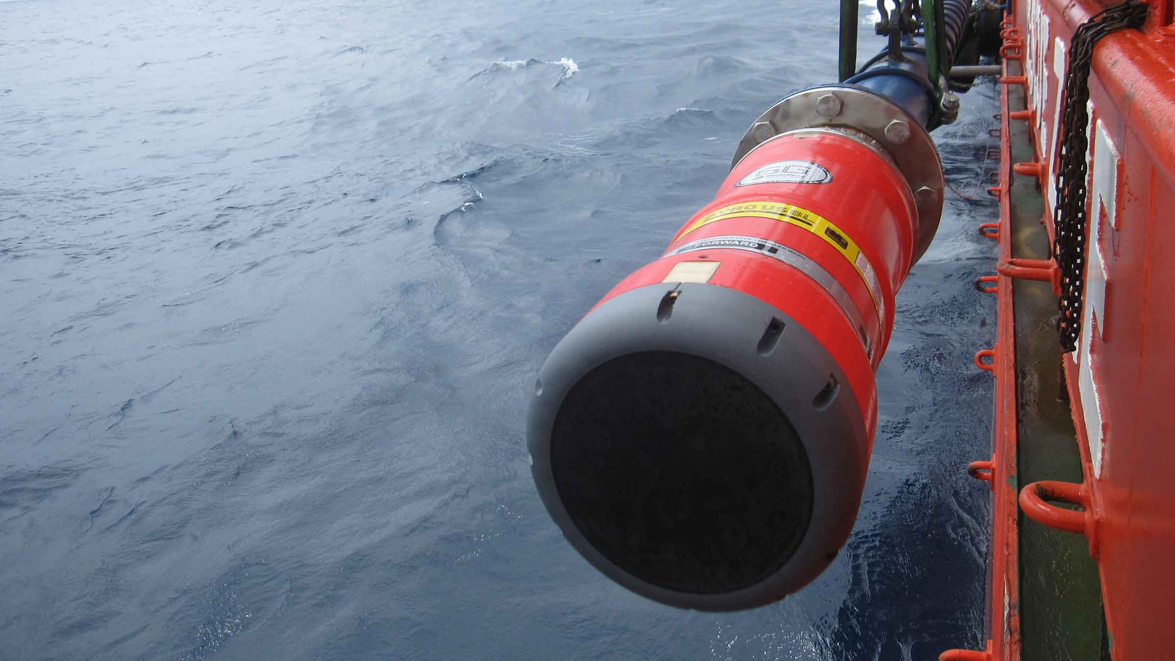
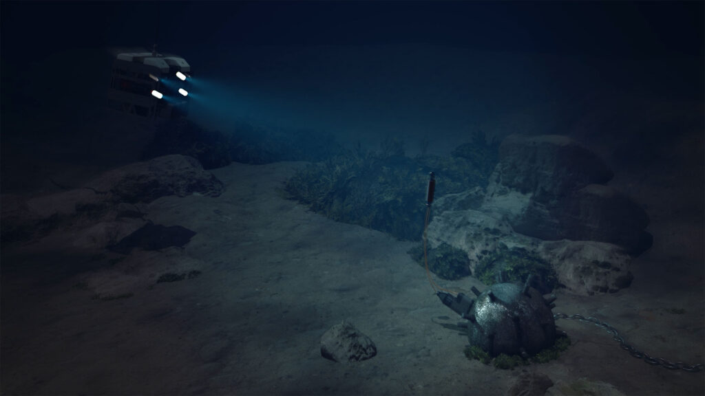
At its core is an On-Demand Ocean Bottom Node, or OD OBN. This semi-permanent seabed system is used for the acquisition of high resolution seismic and seafloor subsidence data.
Like conventional seabed nodes (OBN), each OD OBN contains three geophones and one hydrophone, a data recording system, batteries and a highly accurate clock. The sensors detect pressure waves emitted by an airgun source, usually towed by a ship, as they are reflected upwards towards the seabed from the underlying layers of rock surrounding the reservoir.
Unlike conventional nodes, these OD OBNs remain on the seabed, down to 3,000 m, gathering seismic data for up to five years. This significantly reduces the cost of repeated ocean bottom seismic campaigns, as the node handling vessel is removed from the operations. It also reduces the impact on the environment and marine ecosystems.
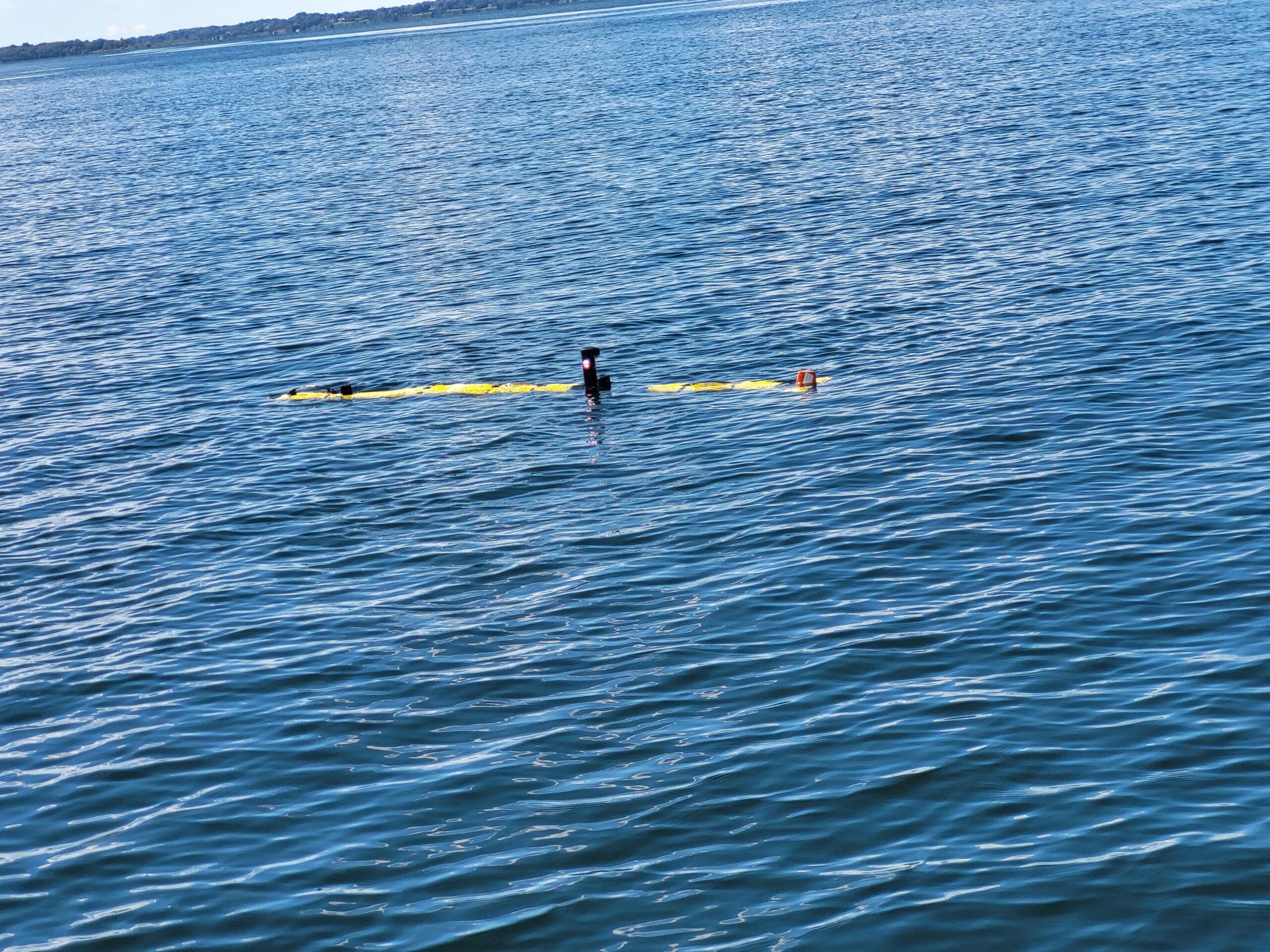
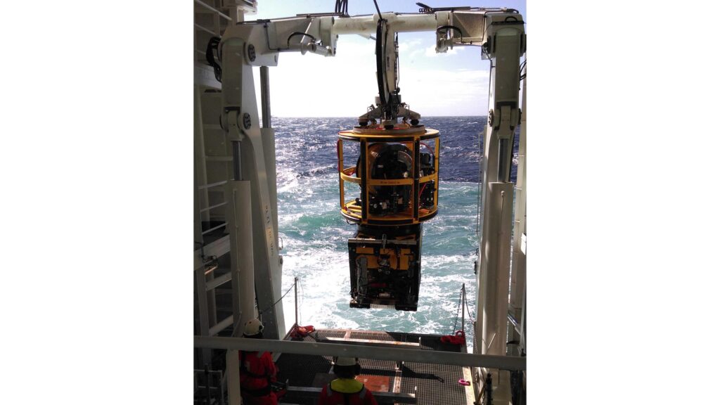
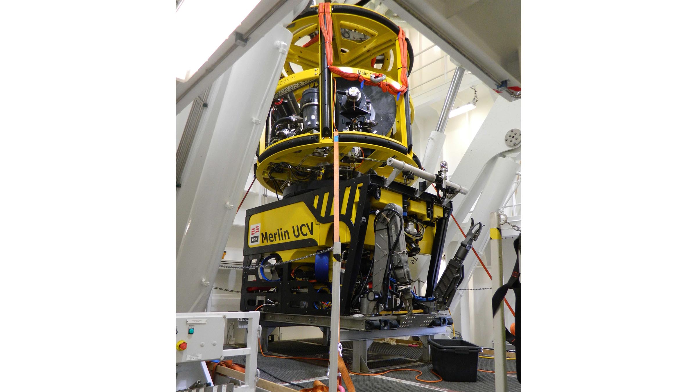
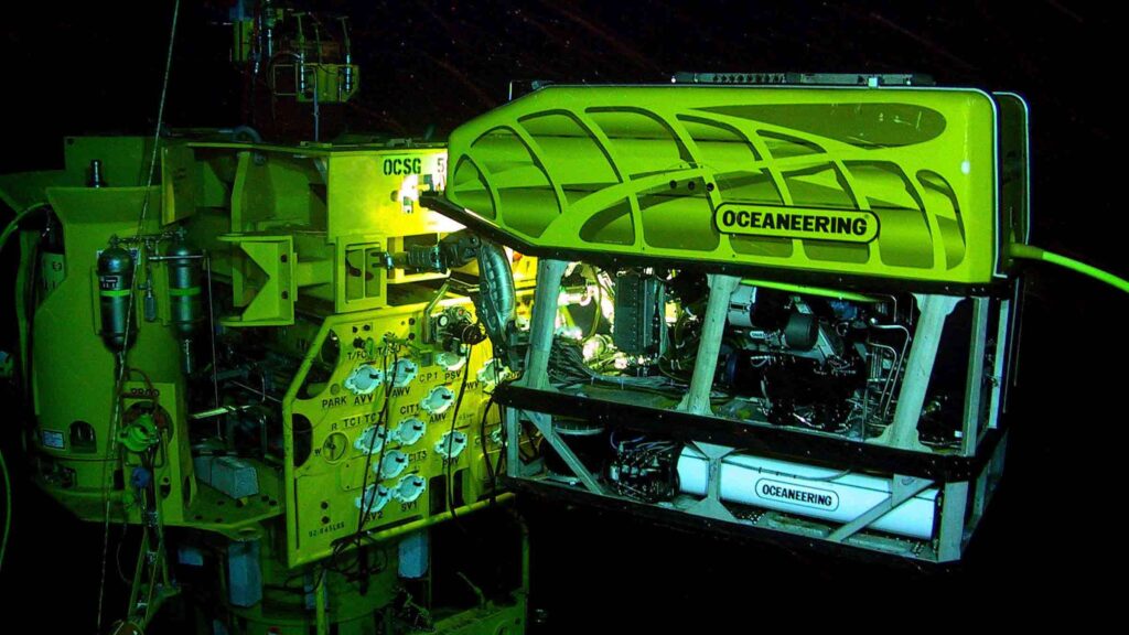
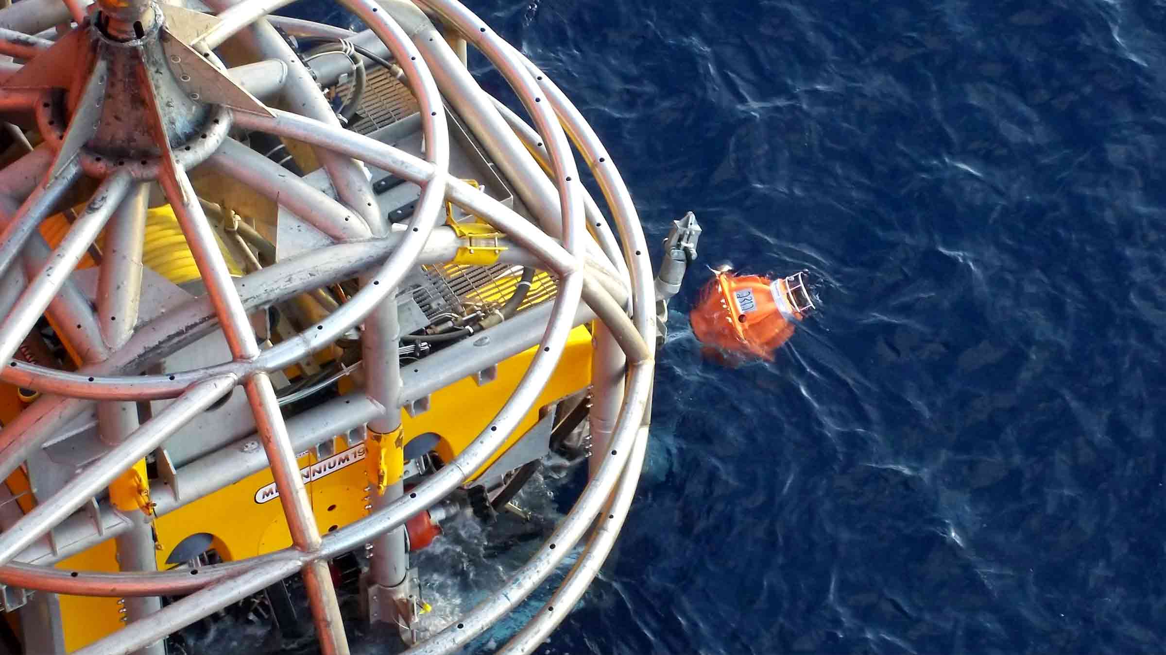
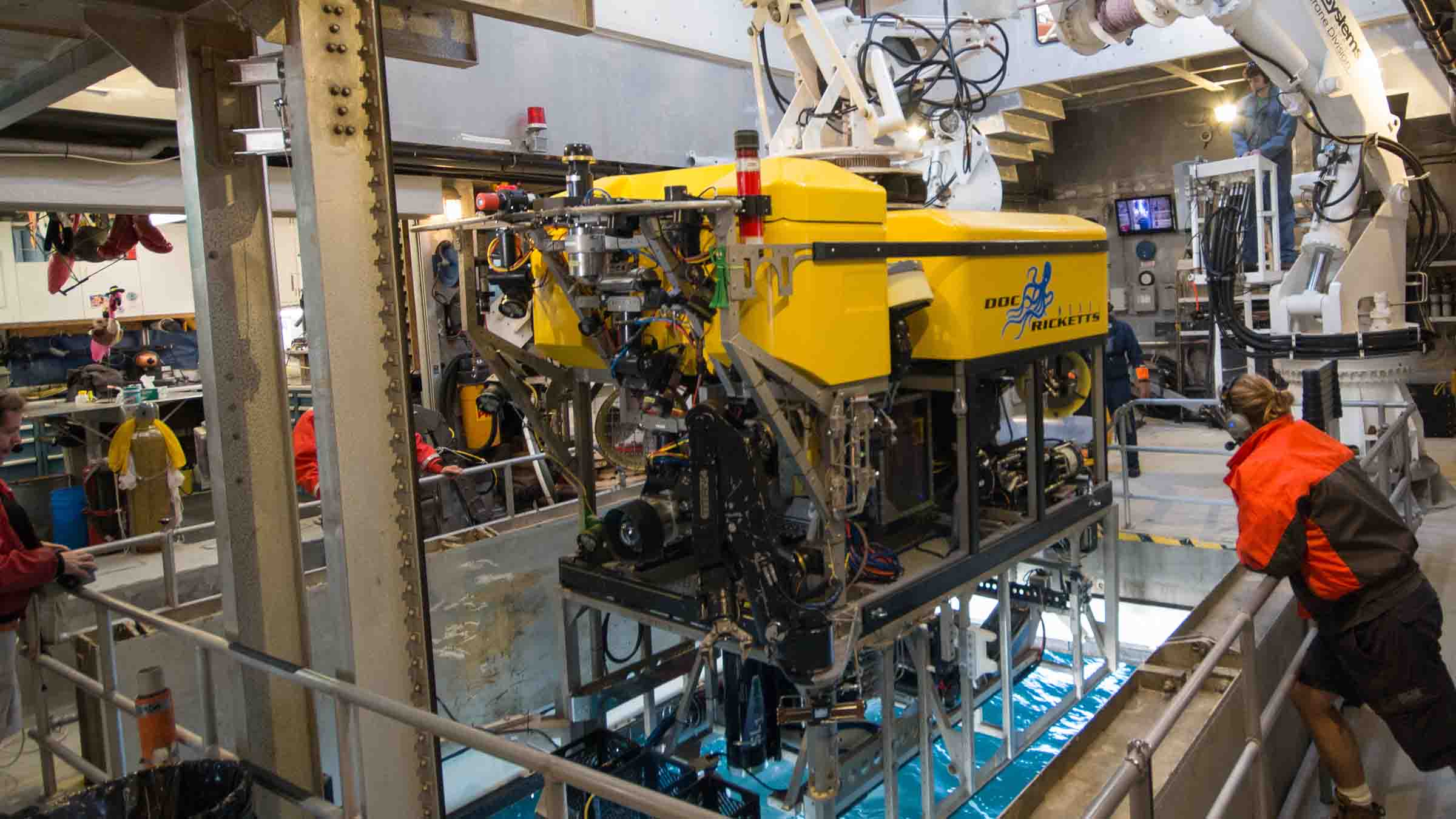
The activation of the nodes, verification of subsidence event alarms, calibration of internal clocks and harvesting of seismic data will be performed using an autonomous underwater vehicle (AUV) called Flatfish developed, in a closely interlinked ANP project, by partners Shell Brasil, Petrobras, SENAI CIMATEC and Saipem.
Flatfish will find each node using Sonardyne’s 6th generation (6G) of acoustic positioning systems. Our acoustics will also support data telemetry with the nodes, for health checks, configuration and acoustic time synchronization. The Flatfish will then hover above each node, in turn. Using an extremely high bandwidth and energy efficient laser-based variant of Sonardyne´s BlueComm optical communications device, it will wirelessly harvest many gigabytes of seismic data in just a few minutes.
This variant uses two rapidly modulated lasers to produce simultaneous bi-directional communications over more than five meters range. It is optimised for peak data transfer performance, with speeds of over 600 megabits per second demonstrated. This makes it excellent for harvesting large amounts of data from seabed nodes.
“Using OD OBN in combination with Flatfish, a 4D seismic campaign in the pre-salt may be executed in a simpler manner, with lower operational cost, lower risk of human exposure and lower environmental impact,” says Jorge Lopez, Manager of Subsurface Technology at Shell Brasil. “On top of this, the nodes also measure seafloor deformation and can continuously monitor for possible subsidence events that may occur during the production of the field.”

The results
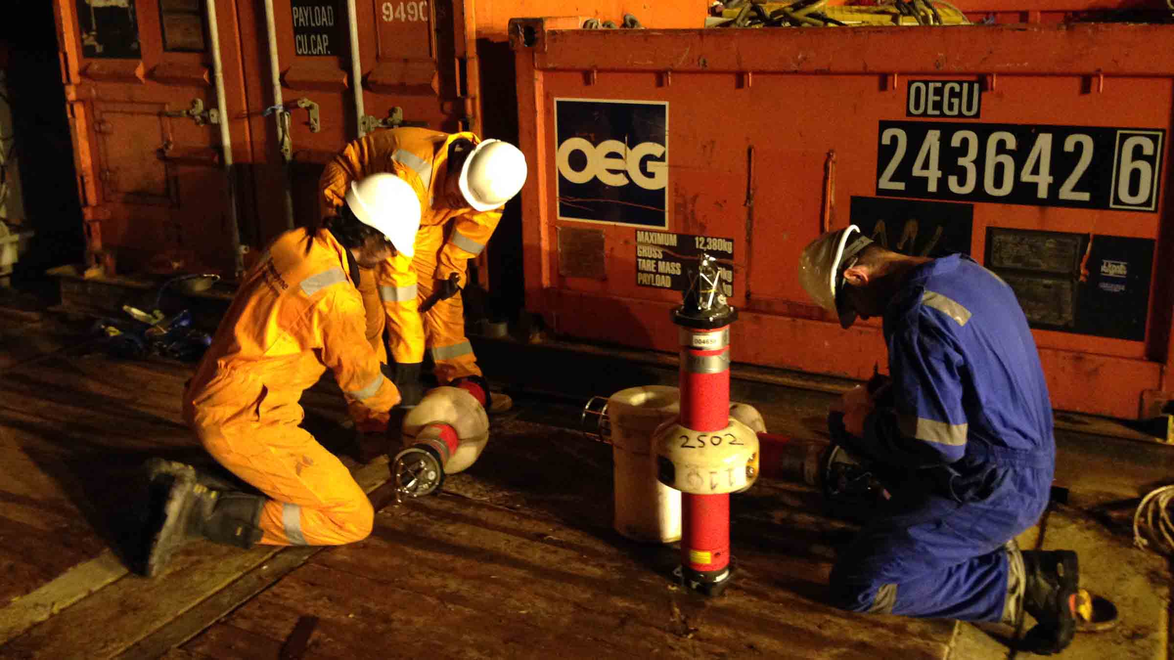
In the first phase of the OD OBN project, eight fully functional prototype nodes were built. These comprised of two different concept types and were designed and built by SENAI CIMATEC in Salvador, Bahia together with Sonardyne Brasil.
In 2021, initial tests of seismic data recording were conducted at the Sapinhoá pre-salt field offshore Brazil and interoperability tests between the nodes and the Flatfish AUV were performed in shallow water in Trieste, Italy.
A very intensive laboratory and offshore testing and demonstration program is being conducted over the next 18 months to ensure the OD OBN system meets its operational requirements. This program will increase the maturity of the solution, with tests in pre-salt fields for recording seismic data with the OD OBN prototypes and the communication and data harvesting AUV missions.
In the next phase of the project, starting later in 2022, Shell and Petrobras will sign a new agreement to manufacture 600 nodes and deploy them for three years of reservoir monitoring in a Brazilian pre-salt field.
Maior eficiência, baixo custo de operação, para sísmica em águas profundas através de autonomia submarina
A Shell Brasil, em parceria com a Petrobras, a Sonardyne e o instituto de pesquisa brasileiro SENAI CIMATEC estão trabalhando juntos para trazer uma mudança radical na coleta de dados sísmicos 4D na região do pré-sal em águas profundas do Brasil.
Descubra como estamos colaborando para desenvolver tecnologia autônoma inovadora que tornará o monitoramento desses desafiadores campos em águas profundas mais eficiente, com menos pessoas e menor impacto ambiental.
O desafio
Os dados sísmicos são uma parte essencial da atividade de desenvolvimento de campos offshore, especialmente para apoiar o gerenciamento proativo de reservatórios e a otimização da produção. As técnicas para coletar esses dados evoluíram dramaticamente ao longo das décadas; desde o uso de streamers marinhos para grandes campanhas sísmicas de exploração até o uso rotineiro de veículos operados remotamente (ROV) para implantar nós de fundo oceânico (OBN) para imagens de alta resolução de reservatórios do pré-sal.
No entanto, a coleta de dados sísmicos para imagens de reservatórios do pré-sal continua sendo um trabalho intensivo. Envolve embarcações tripuladas grandes, caras e emissoras de carbono para implantação e recuperação de, normalmente, milhares de nós. Como exemplo, para uma campanha de 10 meses em um dos campos gigantes do pré-sal brasileiro, uma embarcação de manuseio de nós pode emitir cerca de 10.000 toneladas de CO₂. Operações caras e complexas podem reduzir a frequência de levantamentos, inclusive daqueles feitos para coletar o lapso temporal que é chamado de dados sísmicos 4D, necessários para monitorar os reservatórios do pré-sal.
A Shell e a Petrobras nos procuraram acreditando que poderia haver uma forma mais barata e sustentável de adquirir dados sísmicos 4D, além de outros parâmetros, como subsidência do fundo do mar, para ajudar a monitorar melhor os reservatórios. Eles também viram que isso poderia ser feito com um impacto ambiental menor e mantendo mais pessoas seguras.
A solução
Juntos, Shell Brasil, Petrobras e Sonardyne uniram forças com o SENAI CIMATEC para desenvolver um sistema avançado de aquisição de dados sísmicos em um projeto de pesquisa e desenvolvimento promovido pela Agência Nacional do Petróleo, Gás Natural e Biocombustíveis (ANP).
Em seu núcleo está um On-Demand Ocean Bottom Node, ou OD OBN. Este sistema semipermanente do fundo do mar é usado para a aquisição de dados sísmicos de alta resolução e subsidência do fundo do mar.
Assim como os nós convencionais do fundo do mar (OBN), cada OD OBN contém três geofones e um hidrofone, um sistema de gravação de dados, baterias e um relógio de alta precisão. Os sensores detectam ondas de pressão emitidas por uma fonte do tipo airgun, rebocada por um navio, à medida que são refletidas para cima em direção ao fundo do mar a partir das camadas subjacentes de rocha ao redor do reservatório.
Ao contrário dos nós convencionais, os OD OBNs permanecem no fundo do mar, até 3.000 m, coletando dados sísmicos por até cinco anos. Isso reduz significativamente o custo de repetidas campanhas sísmicas no fundo do oceano, uma vez que a embarcação de manuseio de nós é removida das operações. Também reduz o impacto no meio ambiente e nos ecossistemas marinhos.
A ativação dos nós, a verificação dos alarmes dos eventos de subsidência, a calibração dos relógios internos e a coleta dos dados sísmicos serão realizados por meio de um veículo submarino autônomo (AUV) denominado Flatfish, desenvolvido em um projeto ANP estreitamente interligado, pelos parceiros Shell Brasil, Petrobras, SENAI CIMATEC e Saipem.
O Flatfish encontrará cada nó usando a 6ª geração (6G) de sistemas de posicionamento acústico da Sonardyne. Nossa acústica também suportará telemetria de dados com os nós, para verificações de integridade, configuração e sincronização de tempo acústico. O Flatfish irá então pairar acima de cada nó, por sua vez. Usando uma largura de banda extremamente alta e uma variante baseada em laser com eficiência energética do dispositivo de comunicação óptica BlueComm da Sonardyne, ele coletará sem fio muitos gigabytes de dados sísmicos em apenas alguns minutos.
Esta variante usa dois lasers modulados rapidamente para produzir comunicações bidirecionais simultâneas em um alcance de mais de cinco metros. Ele é otimizado para desempenho de transferência de dados de pico, com velocidades demonstradas de mais de 600 megabits por segundo. Isso o torna excelente para coletar grandes quantidades de dados de nós do fundo do mar.
“Usando OD OBN em combinação com o Flatfish, uma campanha sísmica 4D no pré-sal pode ser executada de forma mais simples, com menor custo operacional, menor risco de exposição humana e menor impacto ambiental”, afirma Jorge Lopez, Gerente de Tecnologia de Subsuperfície da Shell Brasil. “Além disso, os nós também medem a deformação do fundo do mar e podem monitorar continuamente possíveis eventos de subsidência que podem ocorrer durante a produção do campo”.
Os resultados
Na primeira fase do projeto OD OBN, doze nós protótipos totalmente funcionais foram construídos. Estes são compostos por dois tipos de conceito diferentes e foram projetados e construídos pelo SENAI CIMATEC em Salvador, Bahia em conjunto com a Sonardyne Brasil.
Em 2021, os testes iniciais de registro de dados sísmicos foram realizados no campo do pré-sal de Sapinhoá no litoral brasileiro e os testes de interoperabilidade entre os nós e o Flatfish AUV foram realizados em águas rasas em Trieste, Itália.
Um intenso trabalho em laboratório e um programa de demonstração e testes offshore estará sendo realizado nos próximos 18 meses para garantir que o sistema OD OBN atenda aos seus requisitos operacionais. Este programa aumentará a maturidade da solução, com testes em campos do pré-sal para registro de dados sísmicos com os protótipos OD OBN e as missões AUV de comunicação e coleta de dados.
Na próxima fase do projeto, a partir do final de 2022, a Shell e a Petrobras assinarão um novo acordo para fabricar 600 nós e implantá-los para três anos de monitoramento de reservatórios num campo do pré-sal brasileiro.
Mini-Ranger 2 for the next-level USV operations
Fugro is expanding the possibilities of remote marine operations with its growing fleet of SEA-KIT X-class uncrewed surface vessels (USVs) and eROVs. Read on to learn how our Mini-Ranger 2 Ultra-Short BaseLine (USBL) positioning system supports their remote capability.
The challenge
Leading geo-data specialist Fugro has a clear goal – to achieve safer, faster and more sustainable operations. One of the ways it’s doing that is by using uncrewed surface vessels (USV) to carry out subsea inspection, construction support and hydrographic and geophysical surveys operations.
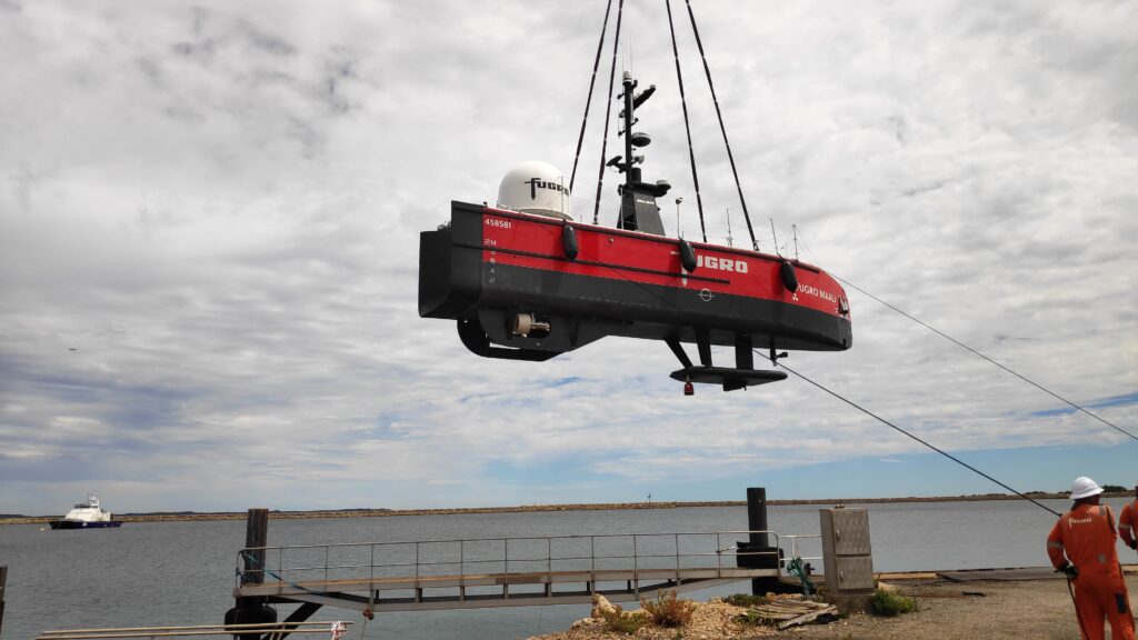
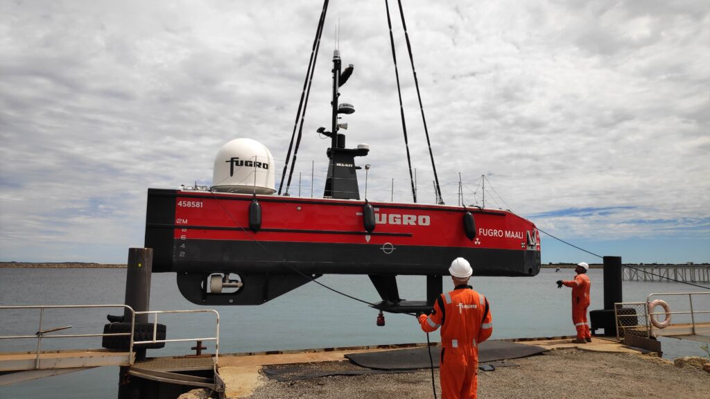
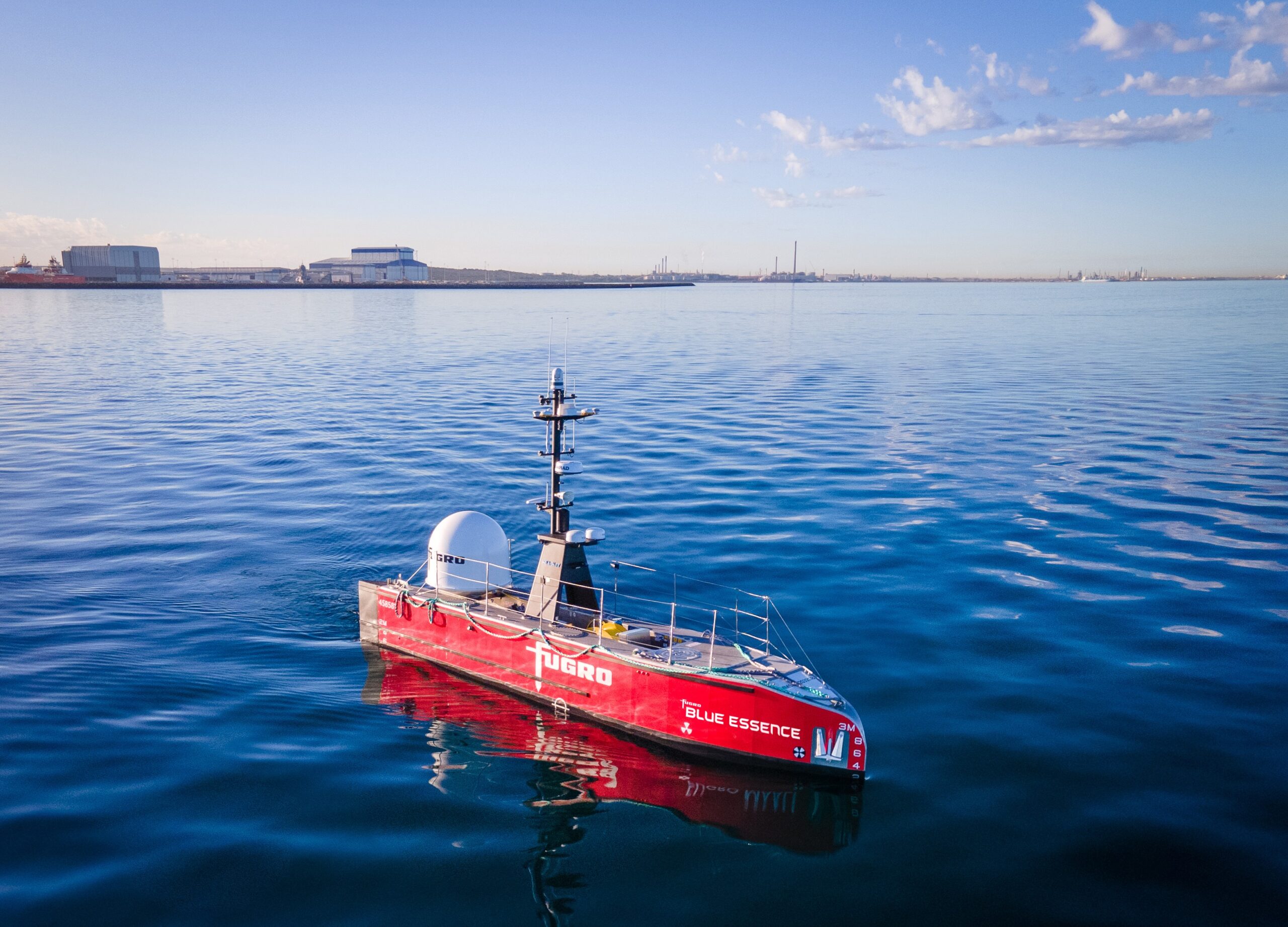
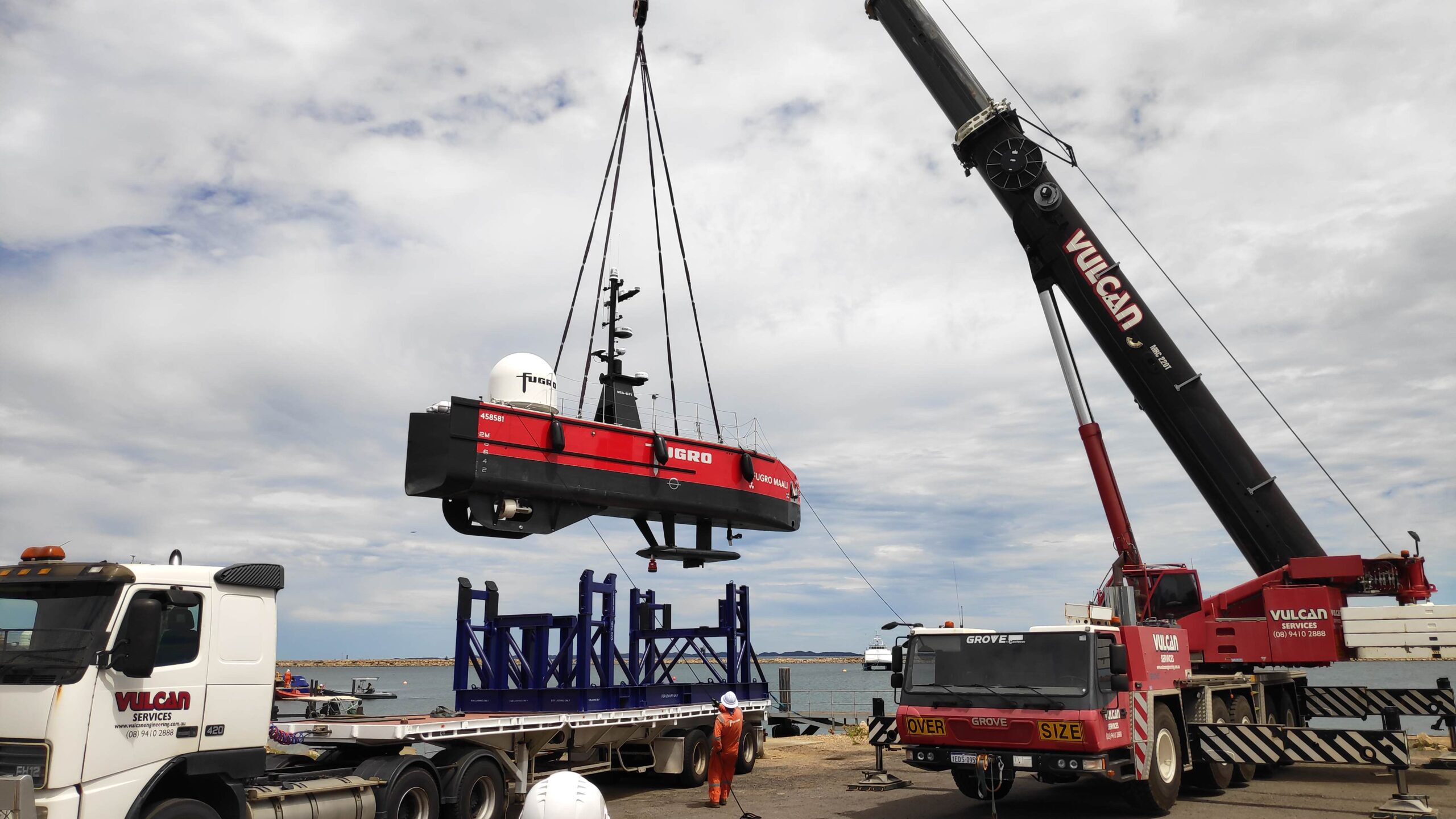
Fugro’s fleet is initially being built with several 12 m-long SEA-KIT X class USVs, named Blue Essence™ by Fugro, with larger SEA-KIT designs planned. These vehicles are operated over-the-horizon from one of Fugro’s onshore global onshore remote operations centres (ROCs).
The Blue Essence™, Fugro Maali 12 m USV can be remotely launched and recovered by personnel at the ROC.
To ensure accurate control and high quality data gathering during its operations using the ROV, Fugro needed a suitable underwater Ultra-Short BaseLine (USBL) positioning system. In particular, Fugro was focused on shallow water inspection operations in 5 – 150 m water depth, that would involve long layback tracking.
The solution
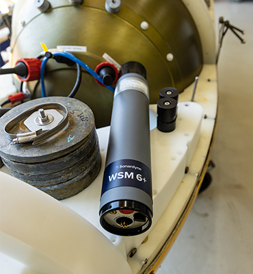
Fugro selected our Mini-Ranger 2 Ultra-Short BaseLine (USBL) underwater positioning system and a Wideband Sub Mini 6+ (WSM 6+) transponder/responder for tracking the ROV.
Mini-Ranger 2 provides a high level of performance without the complexity of a deep water USBL system. It’s compact and easy to install, yet supports tracking, telemetry and control with an operating range of 995 m, extendable to 4,000 m.
At its heart is our HPT 3000 transceiver. It’s low weight (9.5 kg in water) and power draw, so it has minimal impact on any USV’s key performance budgets. It’s optimized for use in shallow water, high elevation and long lay back operating scenarios, making it ideal for Fugro’s shallow water operations, as well as much deeper water work.
HPT 3000 is compatible with all our 6G transponder options, supporting a wide range of functionality, including tracking, telemetry and control. That can be with up to 10 targets simultaneously, whether that’s ROVs, AUVs or divers. It’s also popular for use in ocean data gathering, thanks to its high data rate data collection capability from underwater.


The results
Fugro’s first SEA-KIT Blue Essence™, called Fugro Maali, was delivered to its base in Perth, Australia, in early 2021. Mini-Ranger 2 was configured with an external AHRS and SVP, as well as Fugro’s Starfix® GNSS, to ensure the best possible results from the system.
The vehicle was put to work straight away on an entirely remote nearshore inspection of three gas trunklines off Australia for the Woodside-operated North West Shelf Project – an industry first.
The inspection covered 1,300 km and included a multibeam survey, visual inspection using the ROV and a cathodic protection assessment of the gas trunklines to comply with Woodside and regulatory requirements, with operations controlled from Woodside’s King Bay Supply Facility and Fugro’s ROC in Perth.
Since then, Fugro Maali has carried out further campaigns through 2021 and into 2022, including subsea asset inspection, benthic habitat mapping and high resolution pipeline surveys.
“We couldn’t be happier with how the Mini-Ranger 2 has performed to date onboard the Fugro Maali USV,” says Matt Lussu, Principal Hydrographic Surveyor, Fugro. “We’ve seen reliable USBL positioning even in moderate sea states. We’ve also had good results with shallow water tracking, even when then ROV is several orders of water depth away from the transceiver.”
Fugro took delivery of its second Blue Essence™ USV in 2021. A third USV is about to be operational in the Middle East. A fourth is in sea trials and a the fifth in build, all with Mini-Ranger 2 onboard. In 2023, the company is also expected to take delivery of its next range USV, the Blue Eclipse™, an 18 m vessel, built by SEA-KIT and based on its XL-class design.
For the USV delivery, we worked closely with Fugro and SEA-KIT to deliver this integrated remote USV operations capability, ahead of the X-Class USV’s first operations offshore Australia.
Bringing special order accuracy to small diameter AUVs
L3Harris has armed its Iver3 AUV with Special Order survey navigation capability – thanks to our Mini-Ranger 2 Ultra-Short BaseLine (USBL) system and AvTrak 6. Find out how – and how it will help cut offshore wind farm survey costs.
The challenge
Demand for underwater surveys in coastal waters as part of the offshore wind life cycle is at an all-time high. There’s little sign of that demand falling, thanks to a global shift to renewable energy. But surveys come at a cost.
To keep costs down, surveyors are looking at innovative ways to survey more seabed more efficiently using smaller AUVs that reduce operational costs by requiring smaller vessels and fewer people and reducing their overall carbon footprint.
This includes International Hydrographic Organization (IHO) classified Special Order standard surveys, which are often specified for pre- and post-surveys underwater power cables and UXO surveys.
To meet navigation requirements, Special Order surveys in shallower waters tend to require ship-mounted sensors, to achieve the absolute positional accuracy required (using the vessel’s RTK/GNSS position).
In deeper waters, heavier, larger diameter AUVs are used. Because they rely on a DVL and an inertial navigation system (INS) for their navigation, they also must be supported by large vessels.
But what if you could perform Special Order surveys in shallower coastal waters with smaller low-cost AUVs, reducing your reliance on large vessels, reducing logistics, emissions and operational costs?
This was the challenge set by customers of L3Harris who were keen to find ways to use their Iver3 AUV for Special Order surveys.
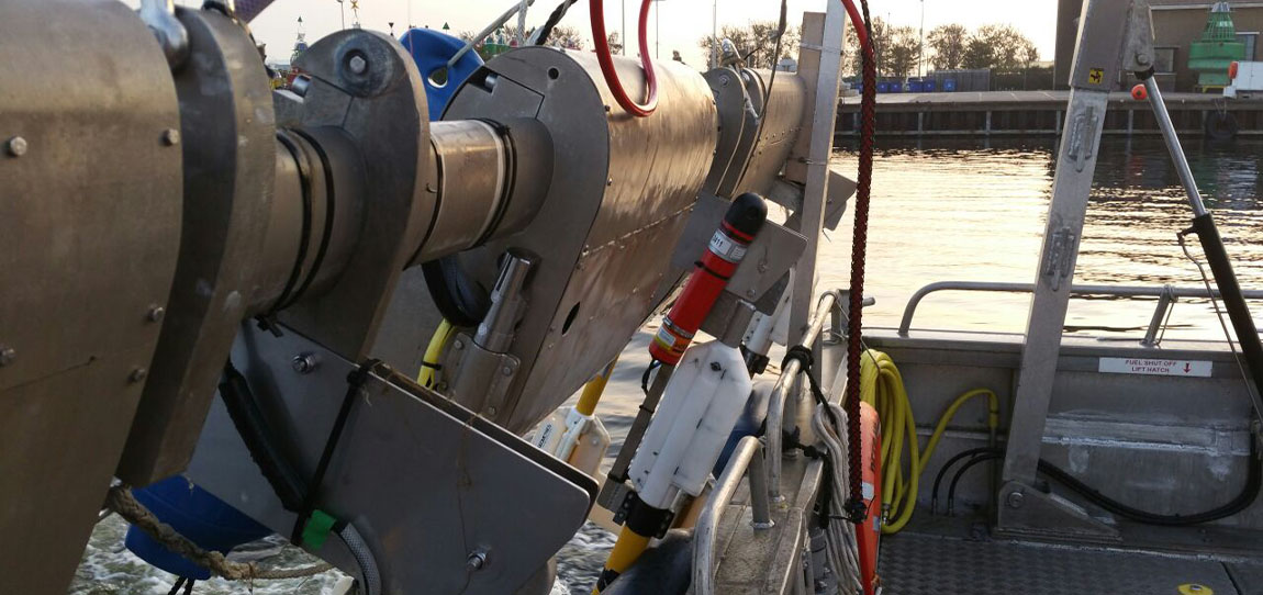
Specifically, they set out to test if USBL-aiding at high enough accuracy for Special Order surveys could be achieved within the size, weight and power limitations of a smaller, light weight AUV platform, such as the 5.8 in-diameter Iver3.
If it could, it would allow underwater run-times of more than eight hours, and a new paradigm in lower operational cost coastal surveys.
The solution
L3Harris had already used our Mini-Ranger 2 for USBL aiding an iXblue Phins INS, via one of our AvTrak 6 OEM Nanos, on one of its Iver3s on a separate customer project. Read more here.
Mini-Ranger 2 is the ideal USBL system for coastal operations, supporting high-elevation tracking of up to 10 targets simultaneously down to 995 m water depth (extendable to 4,000 m), as well as data harvesting. It offers performance without the cost and complexity of a larger deep water USBL system.
At the heart of the system our HPT 3000, a highly capable surface deployed USBL transceiver which is optimized for performance in shallow water, high elevation and long lay back operating scenarios, as well data telemetry.
To provide INS aiding, L3Harris’ customer chose to integrate our AvTrak 6 OEM Nano, with a remote transducer, into their Iver3.
AvTrak 6 OEM Nano is the smallest variant of our AvTrak transceiver, designed for ease of integration on smaller underwater vehicles. It combines the functions of a transponder, transceiver and telemetry link, enabling communications, tracking and USBL aiding for subsea robotics. It’s also based on our 6G hardware platform, which means it’s interoperable with all our USBL, LBL and INS systems. This provides flexibility, but also performance enhancement, for example when combined with a Sonardyne INS.
As in the earlier project, the AvTrak 6 was programmed to speak the right language to the third-party IXBLUE Phins INS, by sending out an APOS PSIM SSB telegram, instead of our proprietary SPOS. The AvTrak 6 transducer was also supplied on a special Iver3 mounting post design, to make it easy to plug and play into the AUV – and any other Iver3, for that matter.
Mini Ranger 2 was pole-mounted to the support vessel with hemisphere GPS for topside absolute positioning.


The results
L3Harris ran a <5 km-long survey, with six 800 m legs, in challenging <20 m water depth in Narraganset Bay on the north side of Rhode Island Sound.
Real-time USBL-aiding improved the survey accuracy by upwards of 7 m on far end of survey legs through the turns. During the survey, real-time survey performance ranges up to 800m were tested with USBL position standard deviations ranging from 1 – 3 m.
In addition, using Mini-Ranger 2’s robotics pack, the L3Harris team were able to provide the vehicle with information of the acoustic environment, so its autonomy could make decisions to adjust the AvTrak 6 OEM Nano’s power and gain settings to improve acoustics without a human in the loop.
“The standard deviation on the USBL position fixes were accurate allowing real-time position updates to the INS. The ease of operation using the Mini-Ranger 2 topside to track and monitor environmental influences throughout the survey also added a layer of safety for monitoring the UUV.”
“This set up allows surveyors to meet Special Order navigation standards, which is a big deal for small unmanned underwater vehicles (UUVs),” says John Sloat, Application Engineering Lead, L3Harris. “The problem before has been that there’s not a lot of real estate inside smaller UUVs to house the onboard technology required for Special Order navigation capability in. But now they can.
“This capability adds a high level of survey efficiency by reducing the need to frequently surface for a position fix which increases the vehicles endurance, reduces the risk of vehicle entanglement or loss, and allows for larger areas to be surveyed. It also means they have real-time data vehicle positioning, which, when post-processed, could be improved even more. That’s really valuable to survey customers and we do see this as the cusp of a new UUV survey era,” adds John.
What was also hugely valuable to the L3Harris team was the support from Sonardyne’s experts.
“The level of support and service from Sonardyne has been exceptional,” says John. “We are very pleased. It’s been a fantastic experience at every phase of the integration we have done and that’s a big de-risk for us, having a partnership like this.”
A 'custom-off-the-shelf' product provides a timely solution for Dana Petroleum
Our experience and expertise allowed us to rapidly adapt our off-the-shelf technology for Dana Petroleum. This delivered a cost-efficient, low environmental impact, and timely solution for them to monitor their suspended wells in the North Sea.
The challenge
As they reach the end of their productive life, oil and gas well heads still need to be monitored whilst suspended – for up to five years, before they become fully abandoned / decommissioned. A regime must be in place to monitor the assets ‘in perpetuity’ to meet government regulations. As this is ‘abandonment expenditure’, rather than capital expenditure, any monitoring schedule must be conducted as cost effectively as possible.
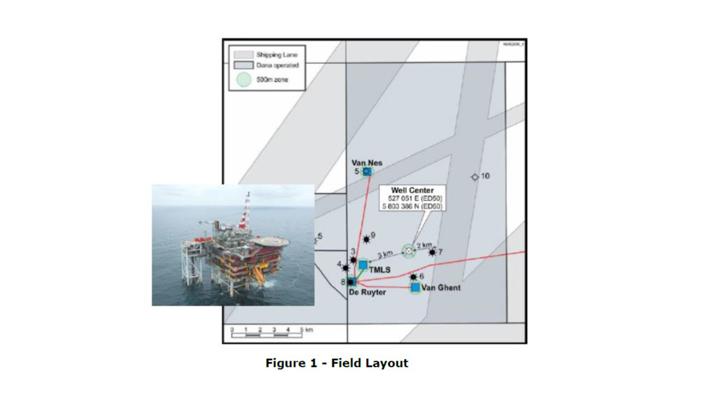
Dana Petroleum (Netherlands) was faced with one such challenge in early 2023 when they needed to plan and implement a well annulus monitoring schedule for suspended wells at their Van Ghent and Van Nes subsea wells, situated in the North Sea approximately 60km West of The Hague. The wells were situated alongside others still in operation and although the topside platform remained, communication links with the sensors on the suspended subsea wells had been lost. There was an additional challenge of the system needing to be in place within 12 weeks.


The solution
The ’simple’ solution would have been to lay new communication cables from the suspended well heads to the topside platform to enable the monitoring. But this would have been lengthy, expensive and carbon intensive, involving bringing in large vessels to lay long stretches of subsea cables. A quicker, cost effective and lower carbon solution was needed. Having heard about Sonardyne’s experience and expertise in long-term subsea asset monitoring, Dana Petroleum approached us for a solution.
We have many years’ experience in providing subsea pressure and temperature data directly from well downhole gauges, mostly during the appraisal phase in a field development, providing essential data to the reservoir engineers before connection is made to the offshore or onshore facility.
Although Dana Petroleum’s requirement was well within our capabilities, there were some initial unknowns such as; field layout, pressure gauge model and manufacturer and how the equipment would be mounted to the subsea manifold. Also, which topside would be most suitable for data harvest? Something which is typically dictated by the vessel size, noise profile and water depth. The timeframe was also very challenging.
In the following weeks, Dana Petroleum provided information on the field layout, drawings of the subsea infrastructure and a strong specification for a system capable of monitoring the annulus pressures at both locations. Having received this, we were able to provide illustrations of previously designed bracketry, 3D CAD images of our potential offering and expert advice to work out the optimum placement to enable best line of site for data harvesting. With a firm specification and known time constraints we looked to our off-the-shelf products with a view to creating a semi-custom solution with our projects team.
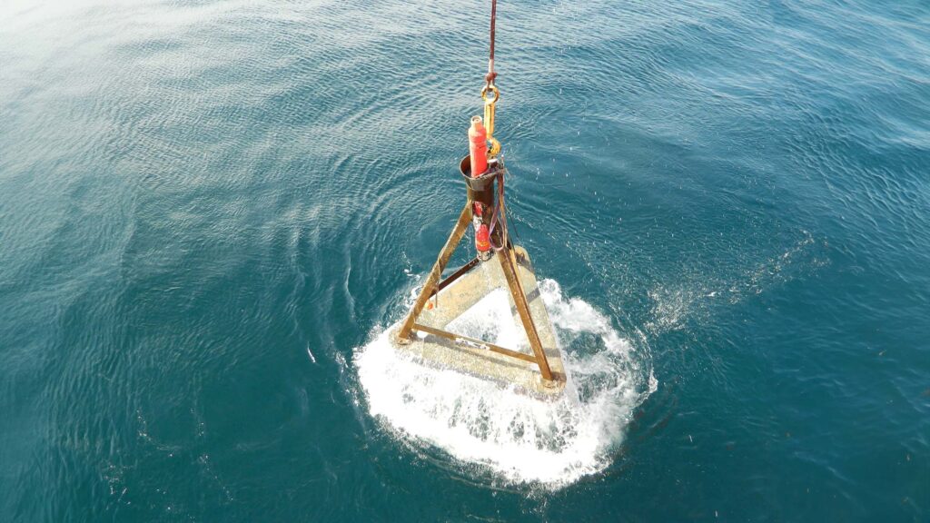
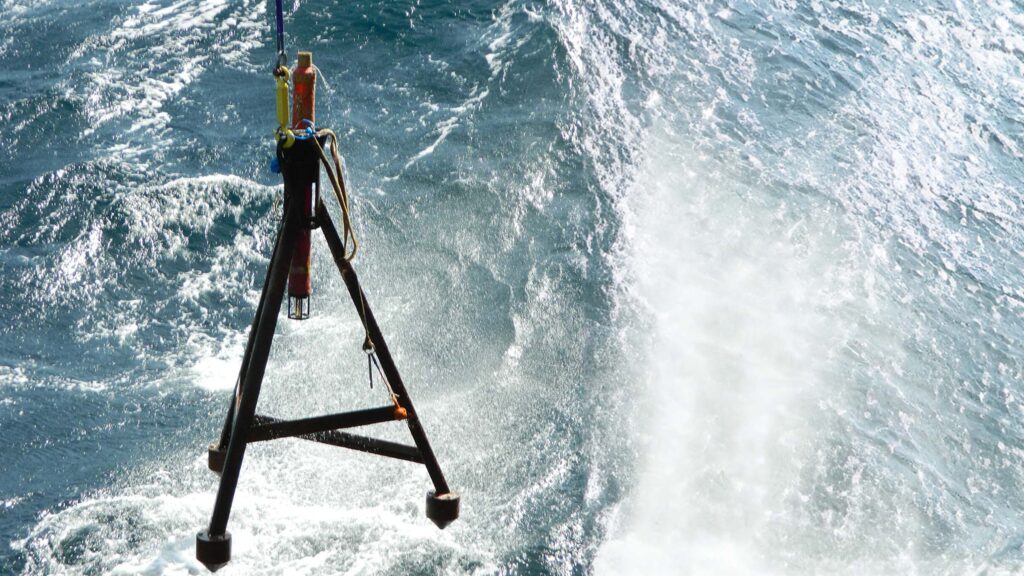
The obvious choice was to make custom alterations to our Autonomous monitoring transponder (AMT). The AMT has been used in a wide variety of different applications including overburden monitoring and pipeline movement monitoring, all utilising and autonomously logging pressure sensor data. These solutions can operate autonomously over long periods of time, over five years – depending on deployment – logging data and making it accessible for wireless upload.
The topside platform of choice was a Nano topside equipped with a ruggedised laptop running Sonardyne’s Monitor software fitted to a small crew transfer vessel that would pass by the wells at regular intervals, delivering workers to the platforms. The size of the vessel dictated a small portable solution but other options are available for all sizes of vessels.
Once the seabed and topside products were selected, custom modifications were made by the projects team to the AMT, allowing the pressure sensor to be connected to the annulus via a flange – rather than inside the AMT –to give flexibility in the location of the AMT and achieve best line of communication with the Nano transceiver when it passed overhead.
A factory acceptance test was witnessed by Dana Petroleum where our projects team provided documentation and coordinated the testing. Following this the equipment was shipped and ready for installation – all within a few months!
The results
The AMTs were installed by N-Sea using the diving support vessel EDT Protea and acoustic connection was established to test the pressure gauges. Readings came back as expected and the system was set logging. Following several days of logging the vessel returned to each well head to harvest the data and prove the system.
Significant cost savings were made by removing the need for new cable infrastructure and utilising a crew transfer vessel for data collection. This also dramatically reduced the carbon footprint of the monitoring schedule.
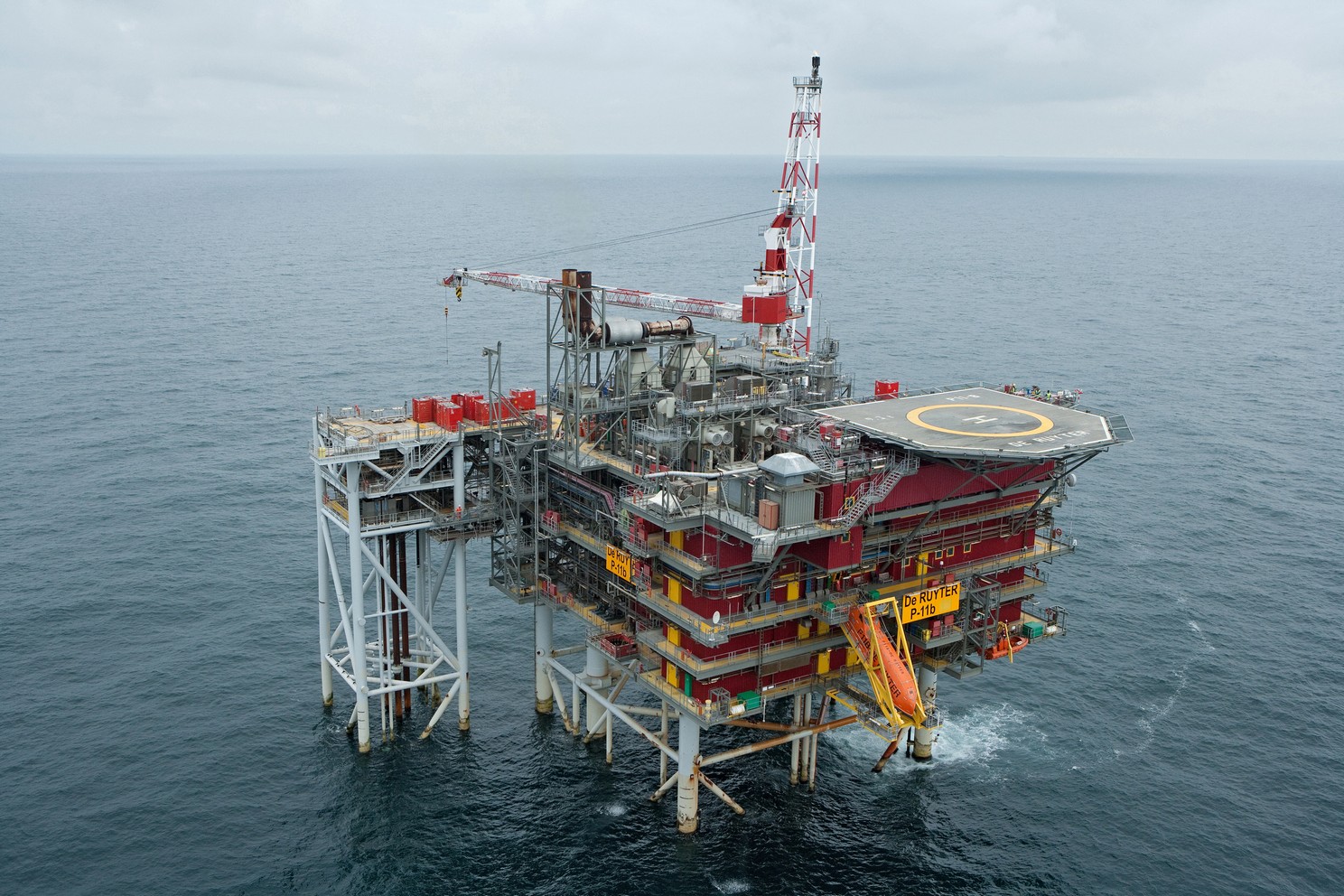
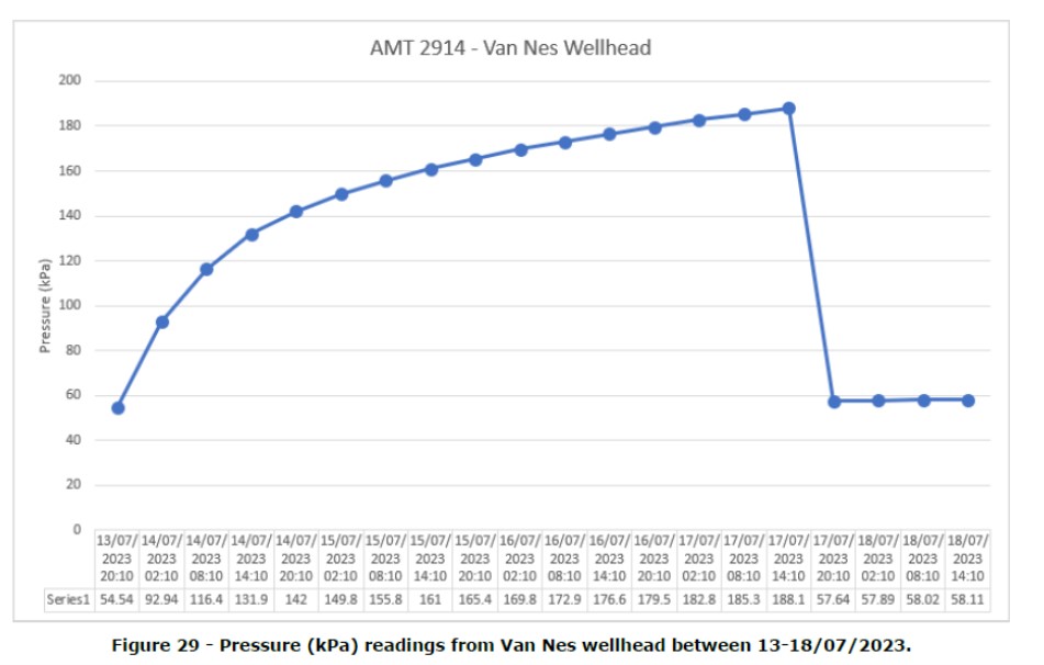
To fully verify the installation, valve settings were changed at the De Ruyter platform and this was visible in the data. The graph above shows a steady increase in pressure after the valve was opened on 13/07/23. The notable drop in pressure between 14:10 (UTC) and 20:10 (UTC) on 17/07/23 shows when the valve was closed.
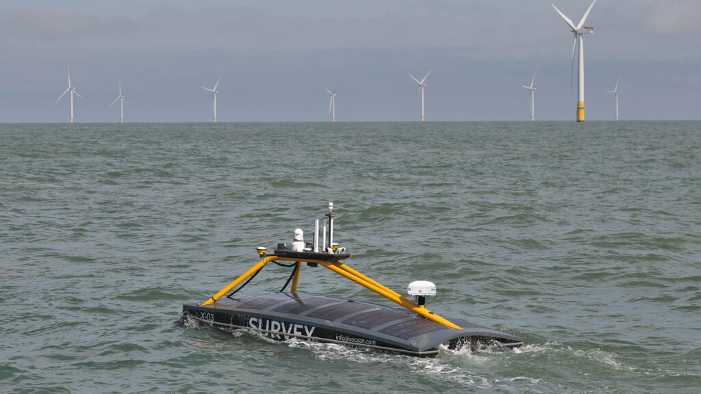
Over the horizon robotic data harvest aids Shell's net zero ambition
Sonardyne, working with XOCEAN’s Uncrewed Surface Vehicles (USV), deliver a lower cost, lower risk and lower carbon, remote acoustic data harvesting service to Shell from their Ormen Lange gas field in the Norwegian Sea.
Shell’s Ormen Lange gas field is a deep-sea site 120 km / 75 miles off the coast of Norway. As Norway’s second largest gas producer, it plays a key role delivering stable gas supplies to Europe. Built on the site close to Storegga, a major landslide which occurred some 8000 years ago, about 5 million tonnes of rock was used to prepare the seabed for subsea equipment back in 2005. The field has been operational since 2007. Ormen Lange is distinctive in that it doesn’t have conventional surface operation platforms.
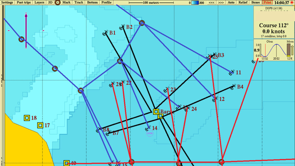
Close monitoring of any seabed movement is key to prevent any potential impact to the pipe system. Monitoring of the ocean floor around the well heads is conducted by seabed sensors. The first monitoring array at the site saw 203 Acoustic Monitoring Transponders (AMTs) installed in 2011. These sensors enabled monitoring of changes in pressure and tilt to provide an understanding of seabed movement.
This array was recovered in 2016 due to battery limitations and uncertainty in drift. Today the monitoring is undertaken by an array of 75 Sonardyne seabed Pressure Monitoring Transponders (PMTs). Shell took the decision to install 30 PMTs in 2019 with a further 45 installed in 2020.
The challenge
Without surface platforms, acoustic data from the subsea sensors had to be harvested by crewed vessels in the early years of the field’s operation. This was costly, carbon heavy and posed a risk to personnel in often challenging sea conditions.
With a company ‘Powering Progress’ strategy to achieve net-zero emissions by 2050, Shell was looking for an alternative data harvest method that would reduce cost and risk as well as its carbon footprint.
The solution
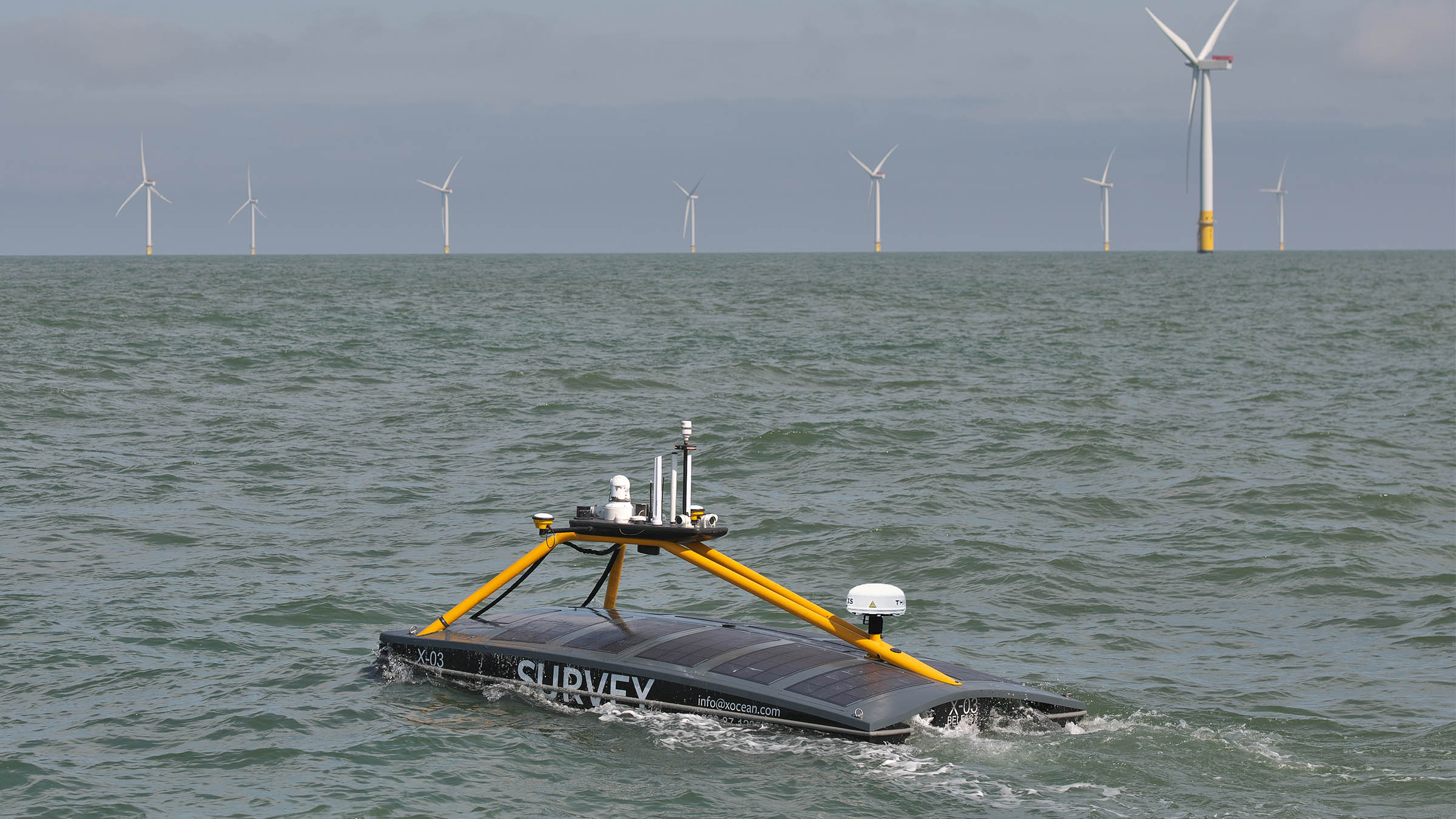
Marine robotic platforms provide the opportunity to remove carbon and personnel risk. Working with the customer and XOCEAN as a sub-contractor we developed a solution that would save time, costs. and carbon, while also eliminating the human risk element, using a USV to conduct the data harvest.
The proposal was to use our HPT 3000 transceiver mounted to an XOCEAN USV to remotely harvest data from the 75 seabed PMTs. The HPT 3000 is perfect in terms of size, weight and power for deployment from a USV and can communicate with seabed transponders at depths up to 995 m (or 4000 m with an extended range version).
XOCEAN USVs are perfect for the data harvesting mission at Ormen Lange. They enable full over-the-horizon 24/7 operations. This means that operators and data analysts can remain safely onshore whilst the operation takes place and data can be sent ashore and verified in near real-time using the USV’s satellite communications.
This satisfied Shell’s commitment to accelerate the transition of their business to net-zero emissions and to integrate sustainability within their business strategy. Following the successful PMT installation in 2019, a five year project was agreed where Sonardyne are responsible for the data delivery to Shell and XOCEAN are responsible for delivering the transceiver to the field for data collection via their USV.


The results
The project began in January 2020 and this was the first time a remote USV data harvest was completed offshore in Norwegian waters by any operator.
Whilst the USV and HPT 3000 were in Norwegian waters surveying the Ormen Lange site, the Sonardyne and XOCEAN personnel never left their bases in England and Ireland.
The data harvest was monitored in real time, 24/7 and the two teams were in contact with each other as well as the remote equipment. This mean that data was being monitored by our team as it was collected and there was no risk of the USV returning with missing or irrelevant data. Had there been any missed or partially collected data the Sonardyne team could ask the XOCEAN team to return to recollect from a particular PMT whilst still in the field, rather than waiting until the vessel returned and having to send it out again.
Successful data harvests have been conducted yearly since 2020 and continue to be a cost effective, low impact operation. This year we collected data from the Ormen Lange site twice, in Spring and Autumn.
If you think you have a similar challenge for us, contact us today.
Autonomous robots prepare to storm the ocean depths
Sonardyne were delighted to be part of the trials of a fleet of marine robots able to tackle complex offshore tasks as part of a ground-breaking project funded by Innovate UK, which is poised to change approaches to ocean exploration. Autonomous marine systems are being developed and deployed in increasing numbers. However, as maritime operations become ever more complex and expensive, and installed energy infrastructure increases in scale and distance from shore, there is a rapidly emerging need for more sophisticated multi-platform capabilities in the offshore renewable energy (ORE) market.
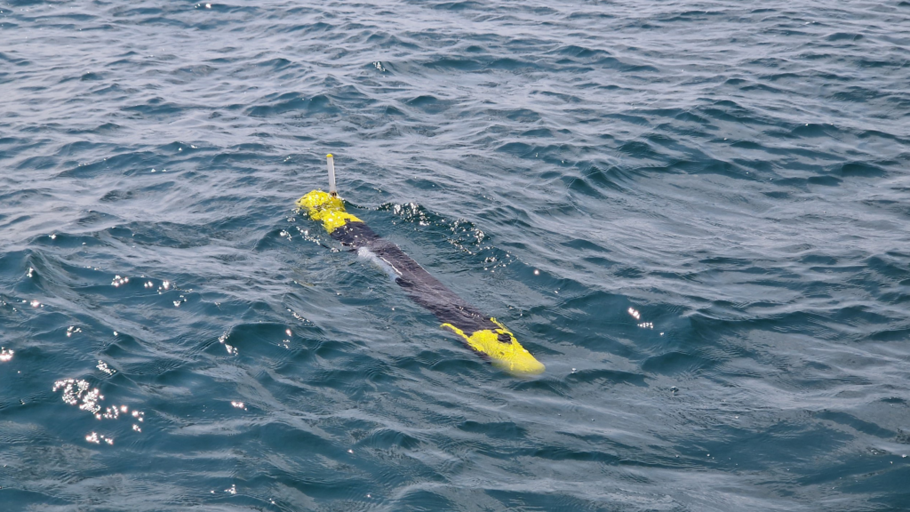
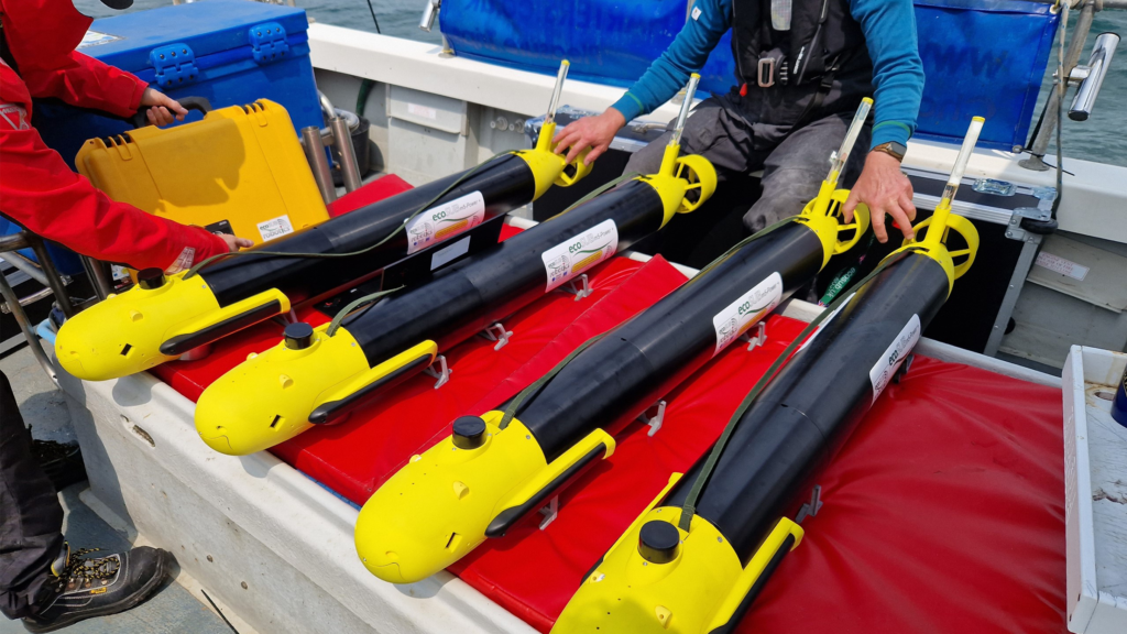
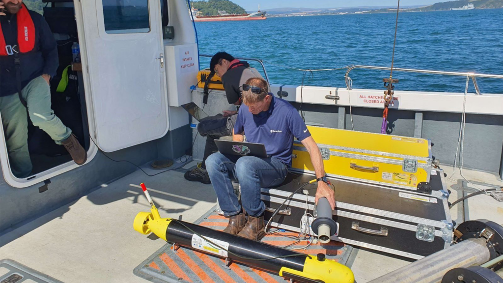
Squads of Adaptive Robots (SoAR) is a two-year collaborative research project, led by the developer of ecoSUB autonomous underwater vehicles (AUVs), Planet Ocean. The project kicked off in September 2021 and culminated this summer with full system testing at Smart Sound Plymouth on England’s south coast.
The SoAR team’s aim was to demonstrate how large-scale survey and exploration missions can be achieved by going beyond the limitations of individual AUVs. We worked alongside industry and academic partners; Planet Ocean, HydroSurv, the National Oceanography Centre (NOC), Royal Holloway University and the Offshore Renewable Energy (ORE) Catapult to develop advanced AI-driven mission planning, communications protocols for fleet coordination and significant improvements in underwater navigation and communications technology.
The trials simulated an offshore windfarm concession survey mission informed by a comprehensive business case analysis by the team at ORE Catapult.
The technology
The fleet-level autonomy engine developed by Royal Holloway, University of London served as the mission’s central nervous system, making real-time decisions and replanning when necessary due to factors such as inaccurate mission execution, vehicle faults, changes in the operating environment or the addition and removal of stations. The division of labour enabled by this approach showed significant promise in productivity gains made possible by robotics and AI.
The SoAR Communications Backbone, developed and released by the team at the NOC, acted as a central messaging system which enabled interoperability between the fleet-level autonomy engine, each vehicle-specific command and control system and any other sub-system requiring bi-directional communication. This was key to allowing the seamless introduction of different platforms and sub-systems in diverse combinations to suit a wide range of mission objectives.
We provided inter-medium communications via our AvTrak 6 Nano acoustic transceivers fitted to each AUV. This enabled simultaneous USBL tracking via a surface vessel and robust telemetry for AUV-to-vessel and AUV-to-AUV communications.
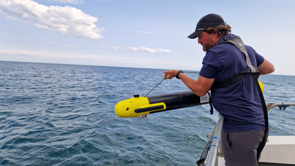
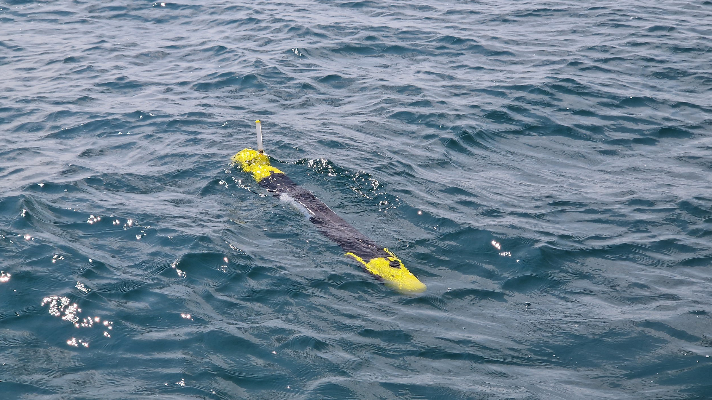
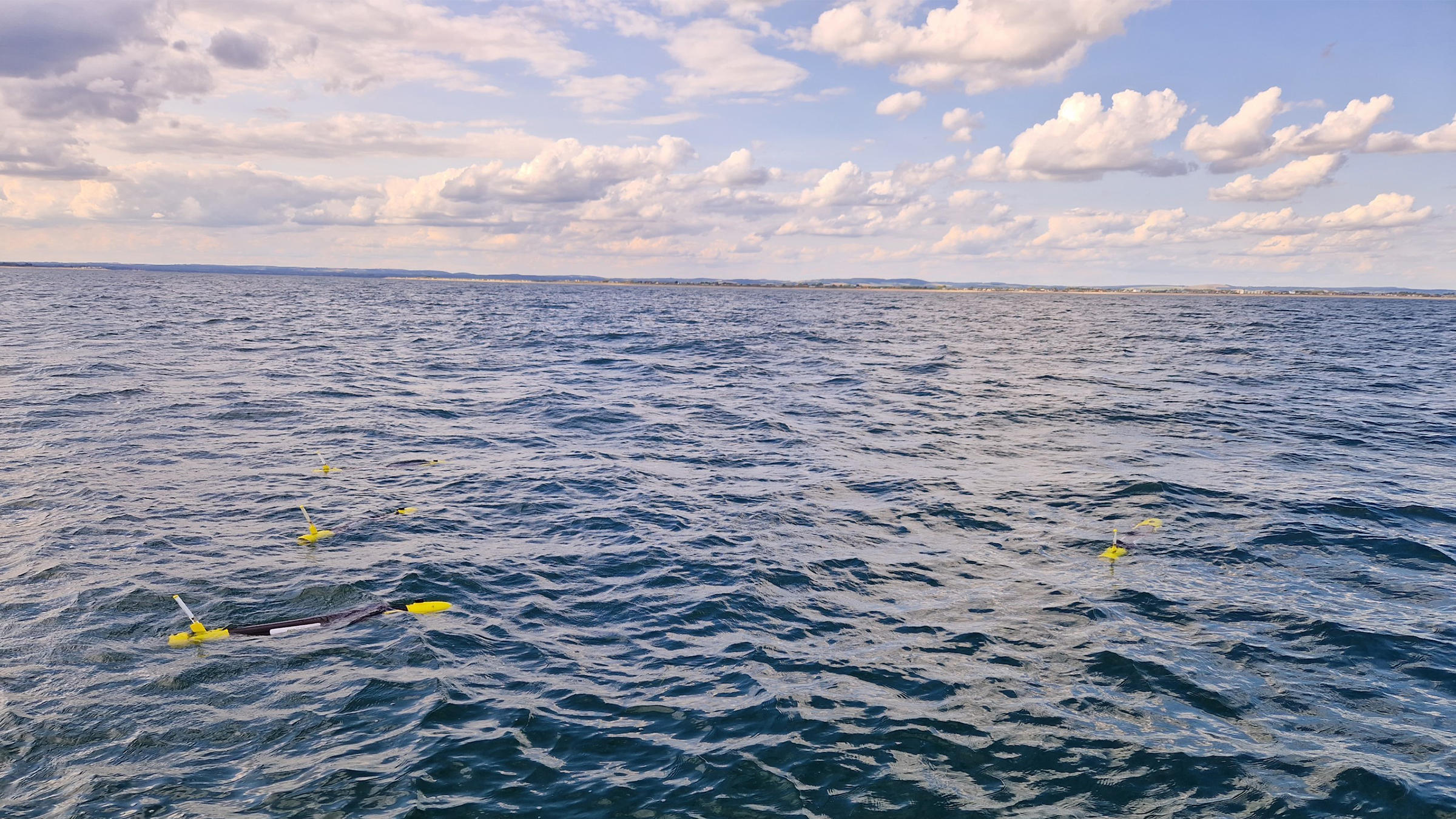
A small swarm of four ecoSUB AUVs, each fitted with an AvTrak 6 Nano acoustic transceiver, played a crucial role in rapidly assessing the underwater environment and conducting preliminary evaluations to identify targets of interest.
An Auto-Hover 1 (AH1) AUV, owned and operated by NOC, capable of exceptional precision in maintaining station and navigating vertically within the water column, and fitted with an AvTrak transceiver, was dedicated to close inspection tasks, enabling intricate and comprehensive examination of identified targets.
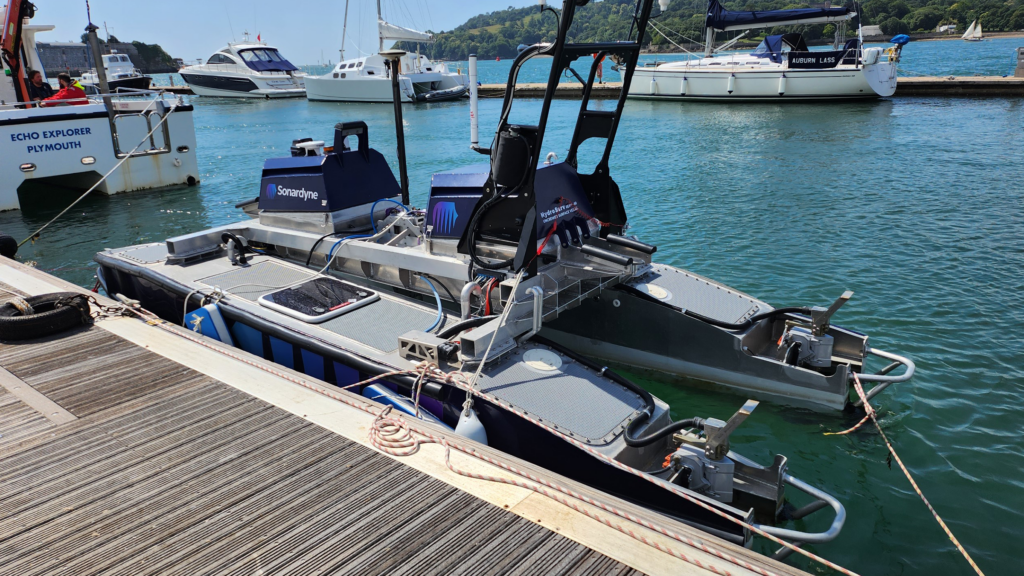
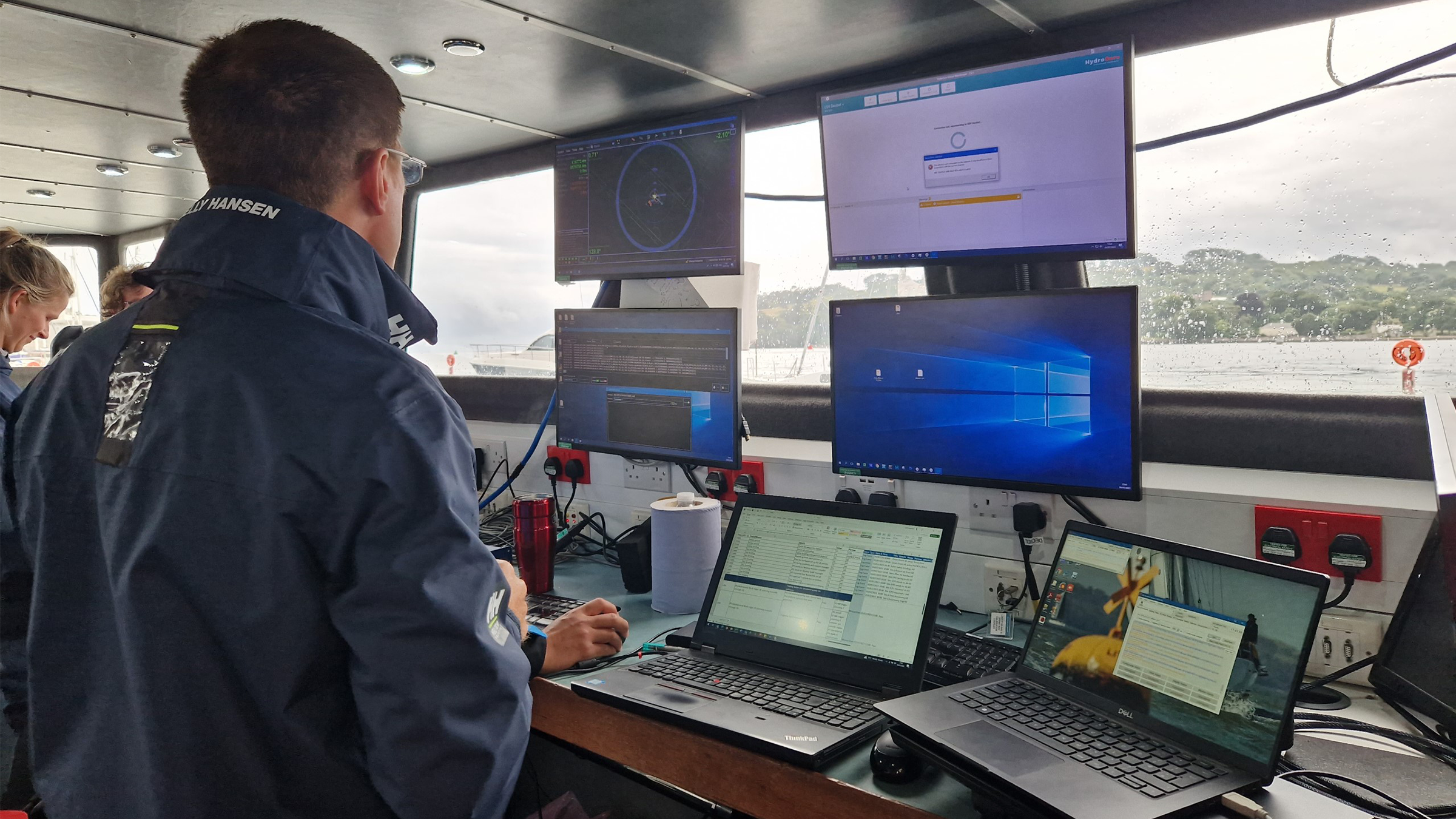
Our HydroSurv REAV-60 uncrewed surface vessel ‘Decibel’ assumed a pivotal role, serving as a crucial communications gateway to and from the AUV swarm. It was fitted with an HPT 3000 transceiver and ran our well-established Ranger-2 software on its topside, facilitating inter-medium communication and providing navigation support to the AUVs. Decibel was also equipped with various communications devices including 4G/LTE and Iridium satellite communication systems to enable communications between subsea, surface and the Autonomy Engine.
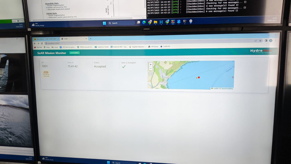
The deployed SoAR fleet was managed and controlled from HydroSurv’s shore-based Remote Operations Centre in Exeter, using 4G/LTE and Iridium communications.


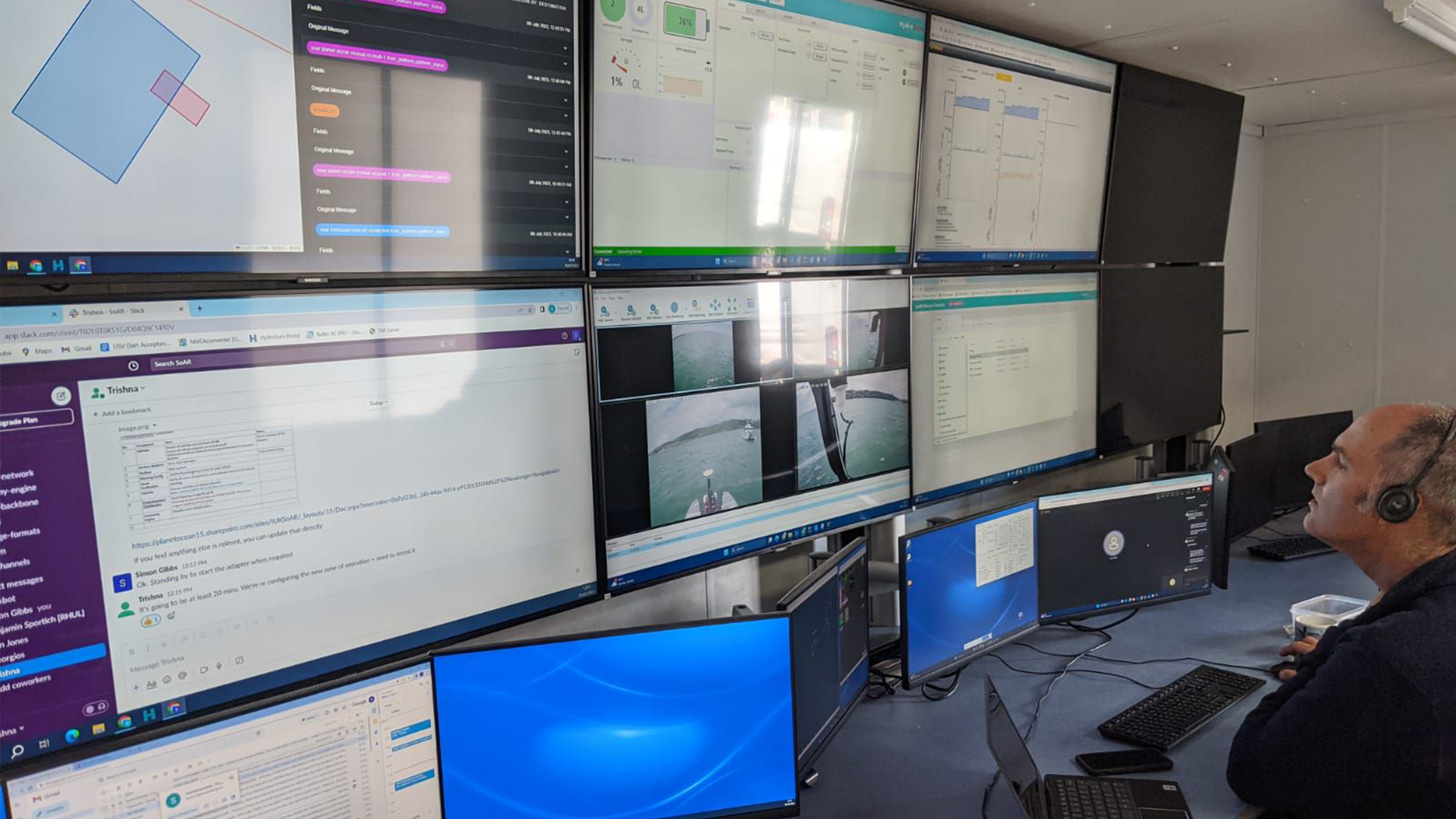


The results
The open-water trials successfully showcased co-ordinated missions designed, monitored and adapted in real-time by an intelligent “Autonomy Engine”. The trials involved several surface and underwater autonomous systems, with mission management conducted from a remote shore-based command and control facility.
SoAR has led to the introduction of several technological innovations, including advanced AI-driven mission planning, open-source communications protocols for heterogenous fleet coordination and a range of new and enhanced platform capabilities for both surface and sub-surface systems. The variety of small form factor robotic platforms involved in the project represented some of the best innovation in UK ocean robotics to date.
The SoAR concept is adaptable to various applications but strategically tailored to address the specific needs of the offshore wind sector, developing an approach that will offer new operating paradigms and substantial long term cost savings for offshore asset construction and maintenance compared to conventional methods.
SoAR received funding from the ‘Next Generation Subsea Technologies’ competition, a joint initiative supported by Innovate UK, the Net Zero Technology Centre and the Royal Navy.
Robotic inspections ensure fish nets are securely anchored
With precise positioning a priority in fish farm mooring maintenance, Aquasky Ltd needed a reliable tracking system for their remotely operated inspection vehicle (ROV). Find out how Micro-Ranger 2 proved equal to their challenge.
The challenge
In aquaculture, second only to the welfare of the fish, the maintenance and exact positioning of the nets and their moorings is critical. With specific areas set aside for fish farms, it’s important that the nets don’t drift out of place or into shipping lanes. To maximise production, fish farmers need to moor as many nets as possible within their area whilst ensuring the moorings don’t damage each other. All of this requires careful and precise placement and inspection, which is where Aquasky Ltd excel.
Aquasky Ltd first operated as a small diving company servicing local fish farms along the west coast of Scotland. During 2011/13 it branched out into moorings inspections using a Videoray Pro 5 ROV. They continued to grow and now provide their services to all the major fish farm companies operating in Scotland plus some others abroad.
As the aquaculture industry has grown so has the size and complexity of its subsea equipment. Aquasky Ltd use an ROV to inspect mooring lines and anchors is to verify their integrity and location. The number of anchors can vary from 26 to over 60 for each site depending on the size of the farm.
Accurate identification of anchor positions is essential. Farmers must ensure assets remain within their lease areas as moving outside can lead to suspension of the lease, with significant financial impact.
It is also essential to maintain separation between moorings to prevent any damage. Anchors being incorrectly positioned can result in the following causes of mooring failure: –
- Anchor chains rubbing through the mooring ropes.
- Mooring ropes contacting rocky reefs and rubbing through.
- Moorings being positioned where the anchors cannot locate firmly into the seafloor, for example on clean rock.
In the event of mooring failure, movement of the cages can initially result in the nets coming into contact with the submerged farm grid system. The nets are then squashed, and the fish are forced into a very small area with reduced oxygen available, resulting in them becoming stressed and dying.
In the event of catastrophic failure, cages can break away and drift ashore or out to sea, resulting in the fish escaping into the wild population.
As part of the inspection process, Aquasky provide their clients with detailed reports confirming the location and condition of the moorings.
In order to meet their requirements, Aquasky needed a positioning system that was accurate, compact enough to fit on a small ROV, reliable and portable so that it could be transported to and used in all of their clients’ locations, including those abroad.


The solution
Portable and quick to mobilise, our Micro-Ranger 2 USBL system can be used from any waterside location or vessel to track divers, underwater vehicles and equipment. Ideal for using in lochs and challenging water.
It is our smallest ever underwater tracking system. Everything is engineered to fit in one medium-sized carry case. Apart from a laptop to run the software, nothing else is needed and the size is so small, it can be carried on a plane. Perfect for when Aquasky find work outside of Scotland.
For their anchor and mooring inspections, Aquasky attach a Micro-Ranger 2 Nano transponder to their ROV which then travels around the fish farms. A transceiver is mounted on a vessel nearby and acoustic signals between the transponder and transceiver are used to establish the ROVs, and therefore the anchor/moorings, position. This position can be displayed for in-water tracking and output in real world co-ordinates for interfacing into external chart plotting systems for the clients reports.
“We needed an accurate positioning system that continues to work as mooring lengths increase and in a noisy subsea environment. Having used other cheaper systems, the Micro-Ranger 2 is the only one able to consistently supply reliable positions for anchors at the 300m length currently used by the farms we service.“ Steve Barlow, Founder, Aquasky Ltd.
The results
By adding Micro-Ranger 2 to their subsea inspection tool kit, Aquasky Ltd are able to provide a service that has become the industry standard for fish farm inspections. Their use of an ROV means that inspections are quicker, safer and less expensive than traditional diver inspections. Using Micro-Ranger 2 ensures that the ROV never gets lost and provides accurate data which is vital for the inspection reports.
Up to
0
%
slant range accuracy
Tracks up to
0
targets sequentially
Maximum
0
m
tracking range
0
Hz
position update rate
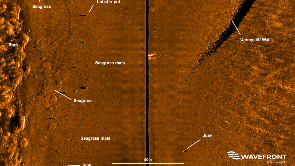
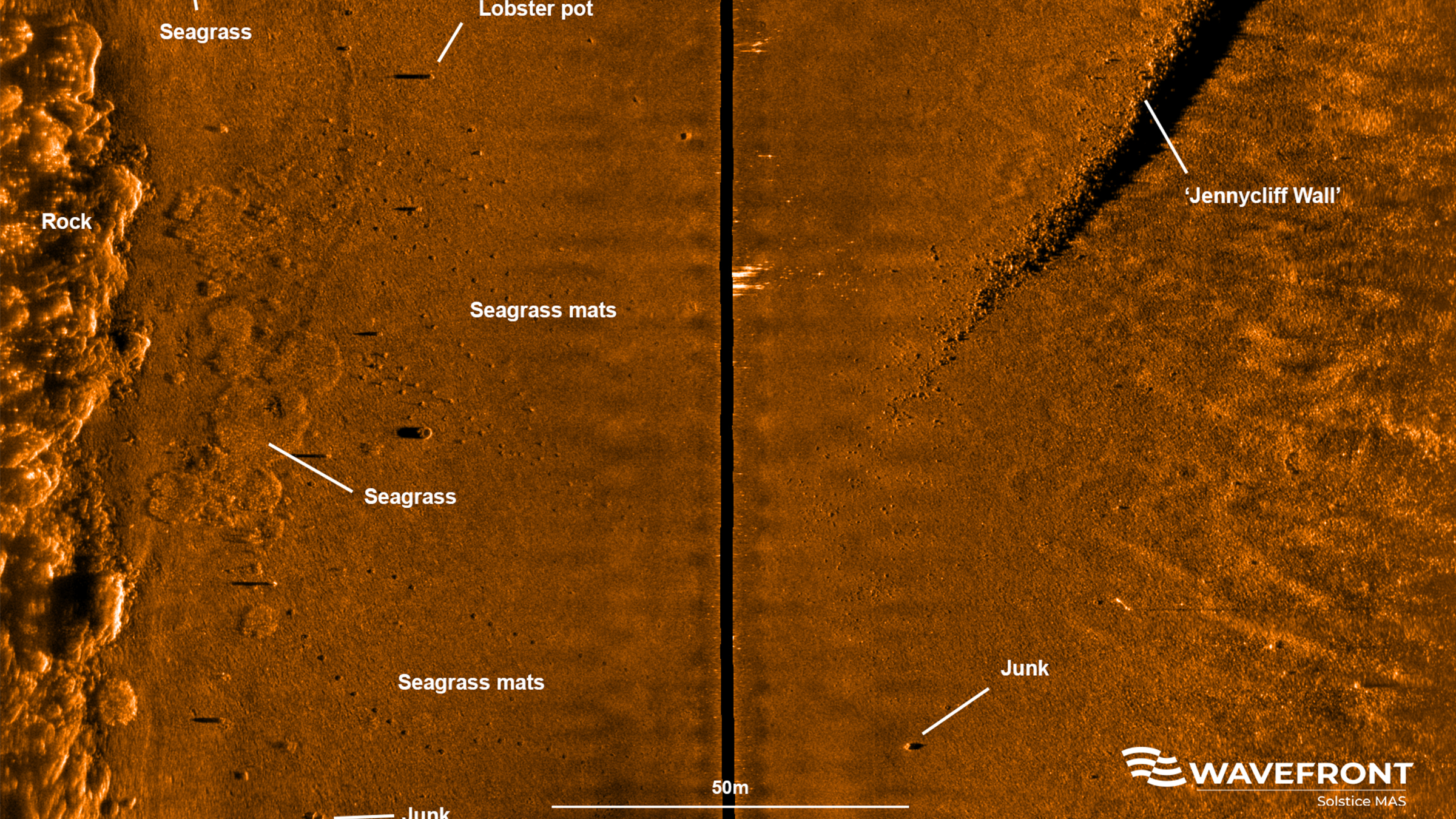
Mapping the future for seagrass beds in Plymouth Sound
Seagrass beds are incredibly important ecosystems that offer a range of ecological benefits. Not only do they provide crucial habitats for a diverse array of marine wildlife, especially in coastal areas like Plymouth Sound, they can also store carbon, helping to mitigate the effects of climate change. These underwater meadows serve as nurseries for many species of fish in the early stages of their life, offering them protection and abundant food sources. Additionally, seagrass beds help to stabilise the seabed with their root systems, preventing coastal erosion and maintaining water quality by trapping sediments and nutrients.
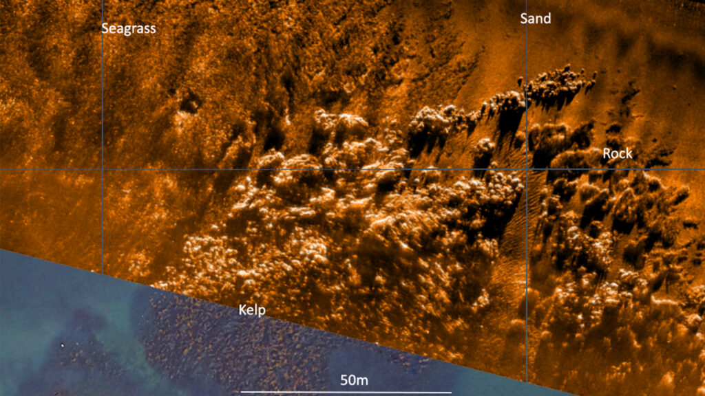


However, despite their importance, locating and monitoring seagrass beds using traditional methods, such as survey boats, presents significant challenges. Seagrass typically grows in shallow waters, which can make it difficult for boats to navigate close enough to the shore to obtain accurate data. Traditional survey boats are often large and cumbersome, making them hard to manoeuvre in shallow or rocky areas. This limitation can result in incomplete or inaccurate assessments of seagrass distribution and health.
Furthermore, the process of using boats for surveying can be time-consuming and labour-intensive. It often requires multiple trips and extensive manual labour to map out the seagrass beds accurately. The visibility in shallow waters can also be poor due to water turbidity, further complicating the survey efforts and leading to potential underestimation of seagrass coverage.
Finding a solution…
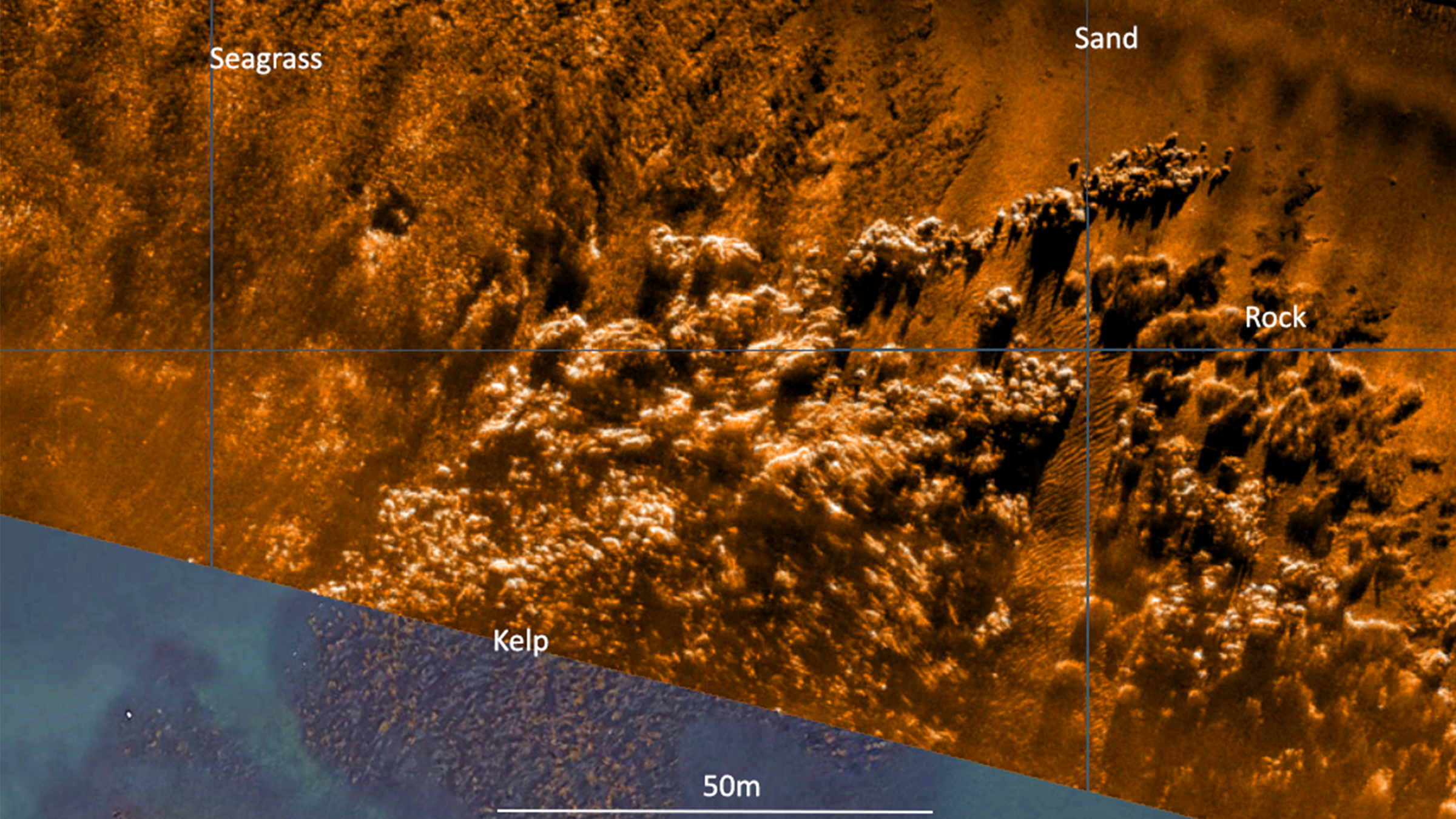
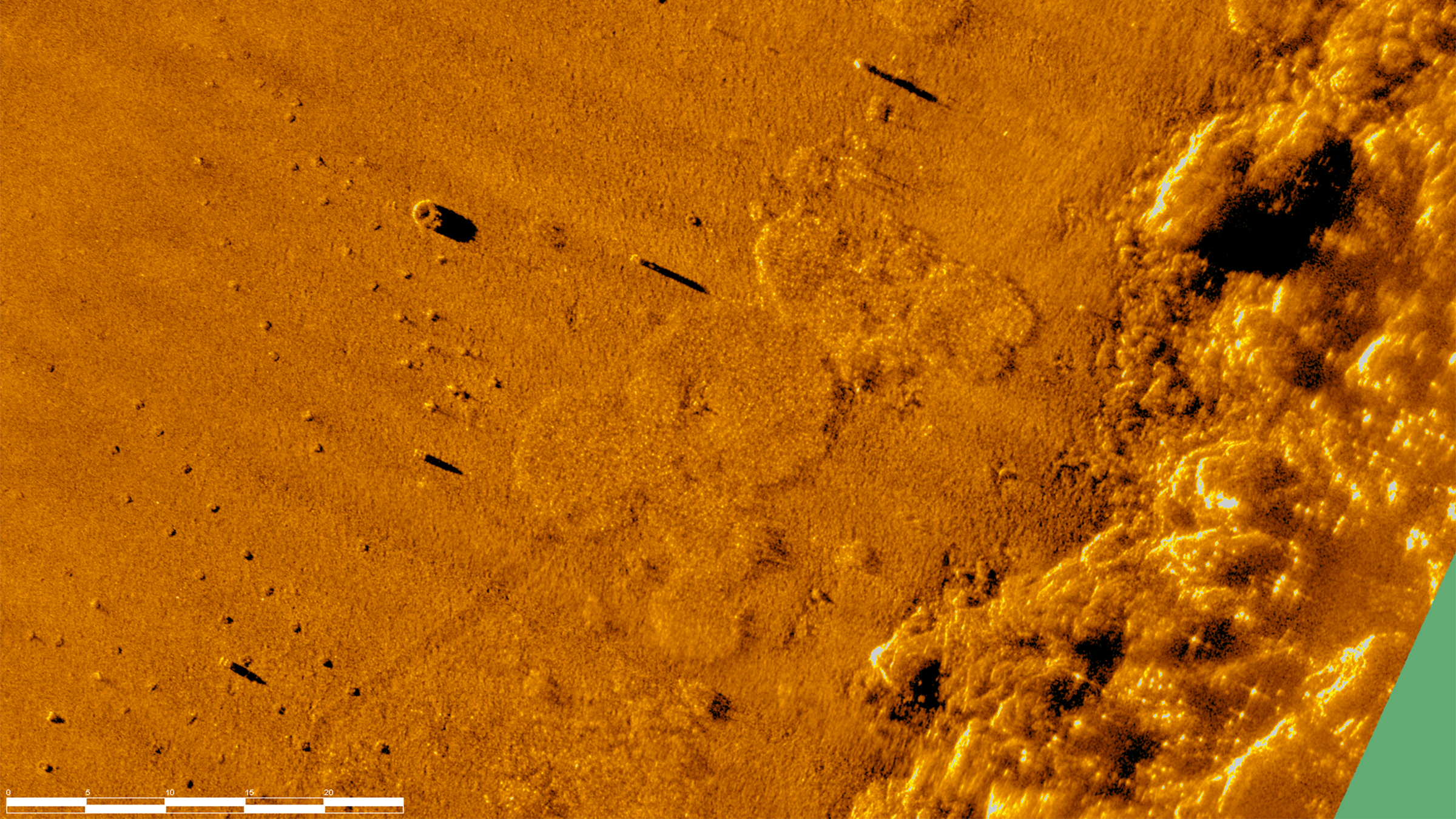
This is where Sonardyne and Wavefront Systems come in. The solution, which combines Sonardyne and Wavefront technology, is a survey boat carrying Solstice MAS™ (Multi-Aperture Sonar) as well as a SPRINT-Nav Mini mounted to a pole, deployed over the side of the boat; this maps the chosen area in 200 m wide strips. Once this survey has been completed, the sonar data that has been captured is then processed to create a map of the seagrass in a GIS. A Remotely Operated Vehicle (ROV) is then sent to the same area to ground truth features on the seabed to check that they are how they have been interpreted by Solstice MAS. The ROV is fitted with SPRINT-Nav Mini, allowing us to track its position underwater and guide it, using the map, to the features identified by Solstice; the ROV is also fitted with a camera and the recorded video can be used to create 3D models of the seabed.
Wavefront Systems’ Solstice MAS uses sound signals to produce high-quality images of the seabed, capable of creating images 200 metres wide at high resolution even in shallow water environments, all while consuming very little power. The Solstice family of sonars are built on unique MAS technology and are designed to fill the gap between standard side scan sonars, which are typically simple in design but give low image resolution, and Synthetic Aperture Sonars (SAS), which are expensive, more susceptible to complete data loss due to platform movement and also produce vast amounts of data. In order to execute more detailed mapping, Solstice MAS requires a high quality navigation sensor, which in this case is SPRINT-Nav Mini.
SPRINT-Nav Mini is an all-in-one vehicle guidance and navigation instrument, which combines AHRS data, Doppler Velocity Logger (DVL), Inertial Navigation System (INS) and depth sensor into a single housing. Having SPRINT-Nav Mini fitted onto the ROV provides positioning input, as well as attitude and heading data.
Creates images
0
m
at high resolution
ROV fitted with
0
D
camera
Solstice creates images
0
m
each side of the vessel
Adopting these technologies on such small versatile platforms opens the possibility of high-grade survey data in shallow waters. As a result of the cross Covelya Group collaboration between Sonardyne and Wavefront Systems, a high-definition map of seagrass beds can be created with a greater degree of accuracy than was previously possible with more traditional methods.
A seagrass restoration project conducted by the Ocean Conservation Trust (OCT) in Plymouth Sound, which involves monitoring, conserving and expanding the existing seagrass beds can be enhanced with the use of an ROV which has SPRINT-Nav Mini fitted to it. To help grow the existing seagrass beds, the OCT are placing seagrass mats on the seabed in Plymouth Sound. A survey boat fitted with Solstice and SPRINT-Nav Mini followed by an ROV fitted with SPRINT-Nav Mini can then be used to monitor and create a map of where these mats have been placed so that they have a better understanding of the success of the restoration and expansion project.
Overview
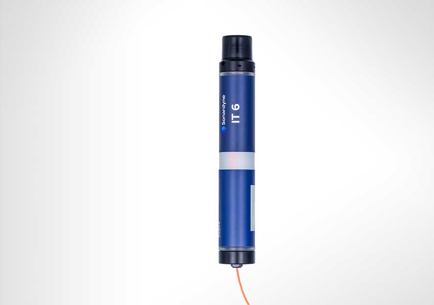
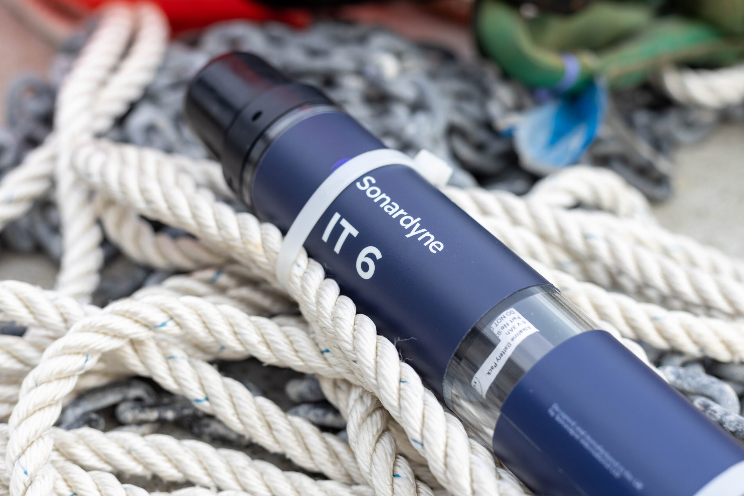
Efficient, secure, safe
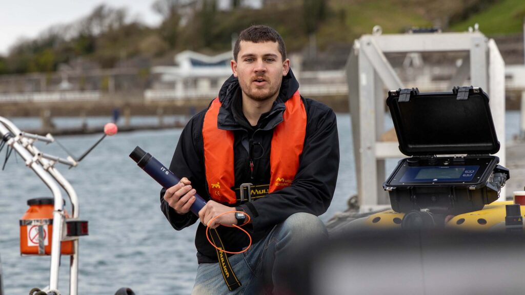
Underwater mine clearance operations put your people, assets and missions at risk. Our Initiation Transponder 6 (IT 6) helps mitigate this risk; enabling mine neutralisers to be efficiently, securely and wirelessly activated from a safe distance. Suitable for a range of scenarios, from military diving, explosive ordnance disposal (EOD), ROVs, MCM and site survey and characterisation
Secure and reliable
When safety is paramount in your survey and clearance operations, IT 6 offers a solution to ensure your success.
For energy: With any offshore energy development, there’s the potential to encounter unexploded ordnance (UXO). IT 6 improves the safety and efficiency of clearance operations, keeping your personnel away from risk and your project on track.
For defence: An important new addition to the MCM and underwater ordnance playbook, IT 6 helps your clearance divers and robotic platforms dispose of modern day and historical ordnance, quickly and effectively.
IT 6 is based on our field-proven Wideband 2 digital signal technology, which offers a reliable and long-range underwater wireless communications link. With IT 6, your personnel no longer need to hard wire mine neutralisers up to signal relay buoys on the surface and can set up an initiation operation in bad weather and outside of daylight hours.
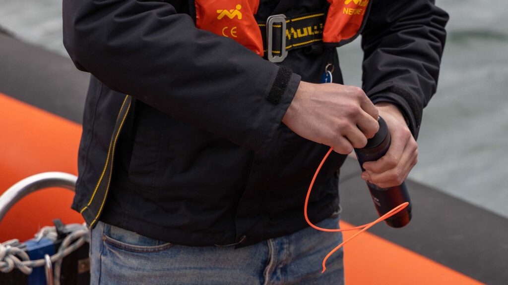
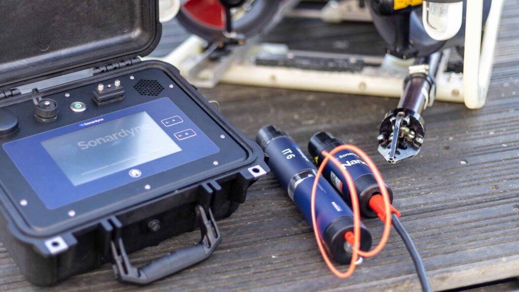
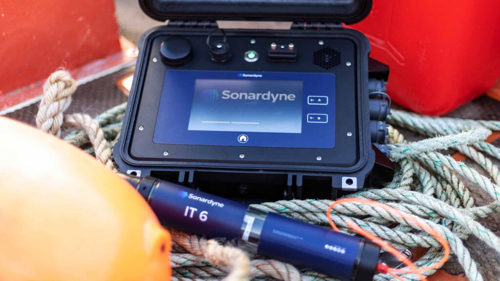
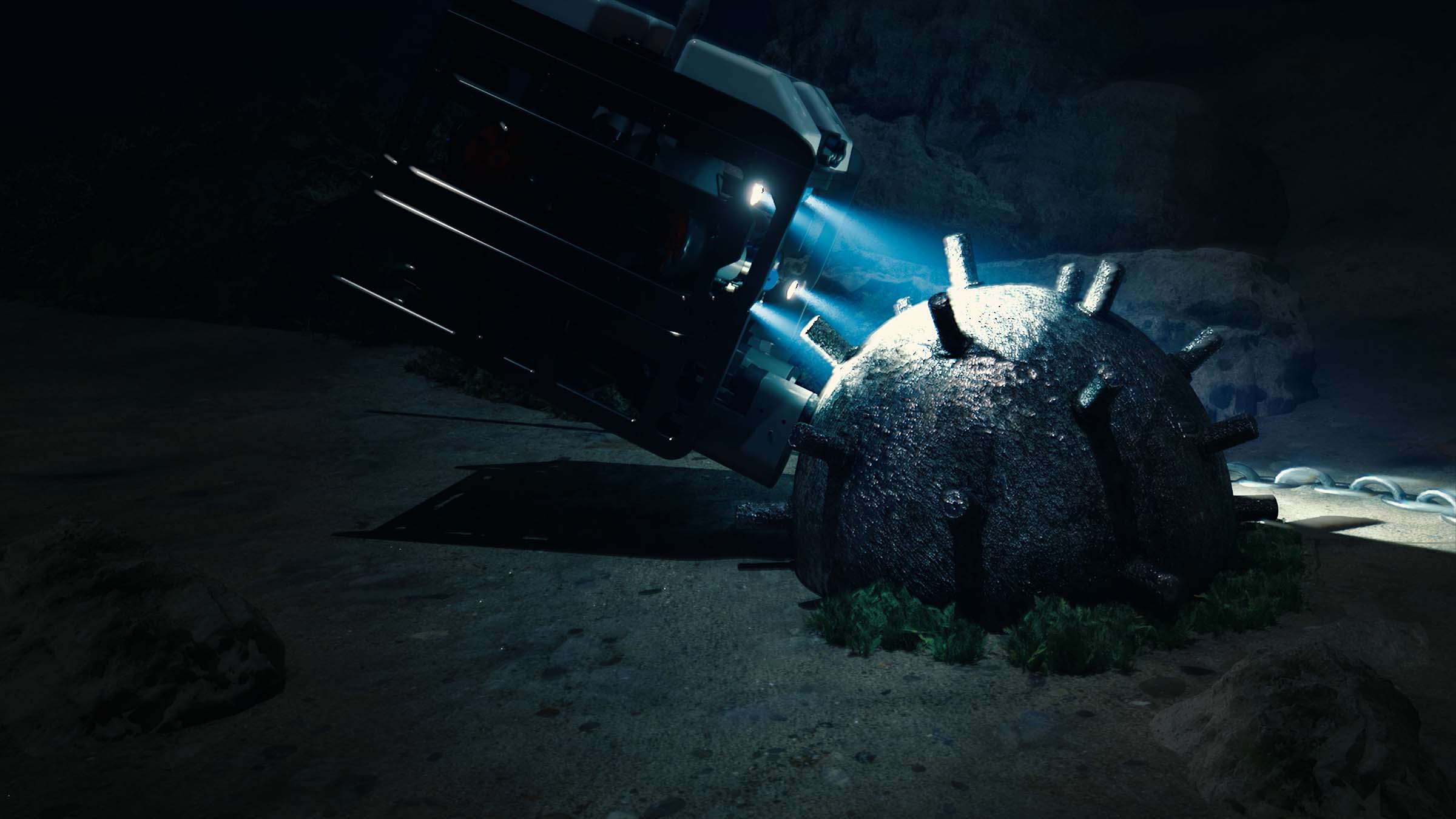
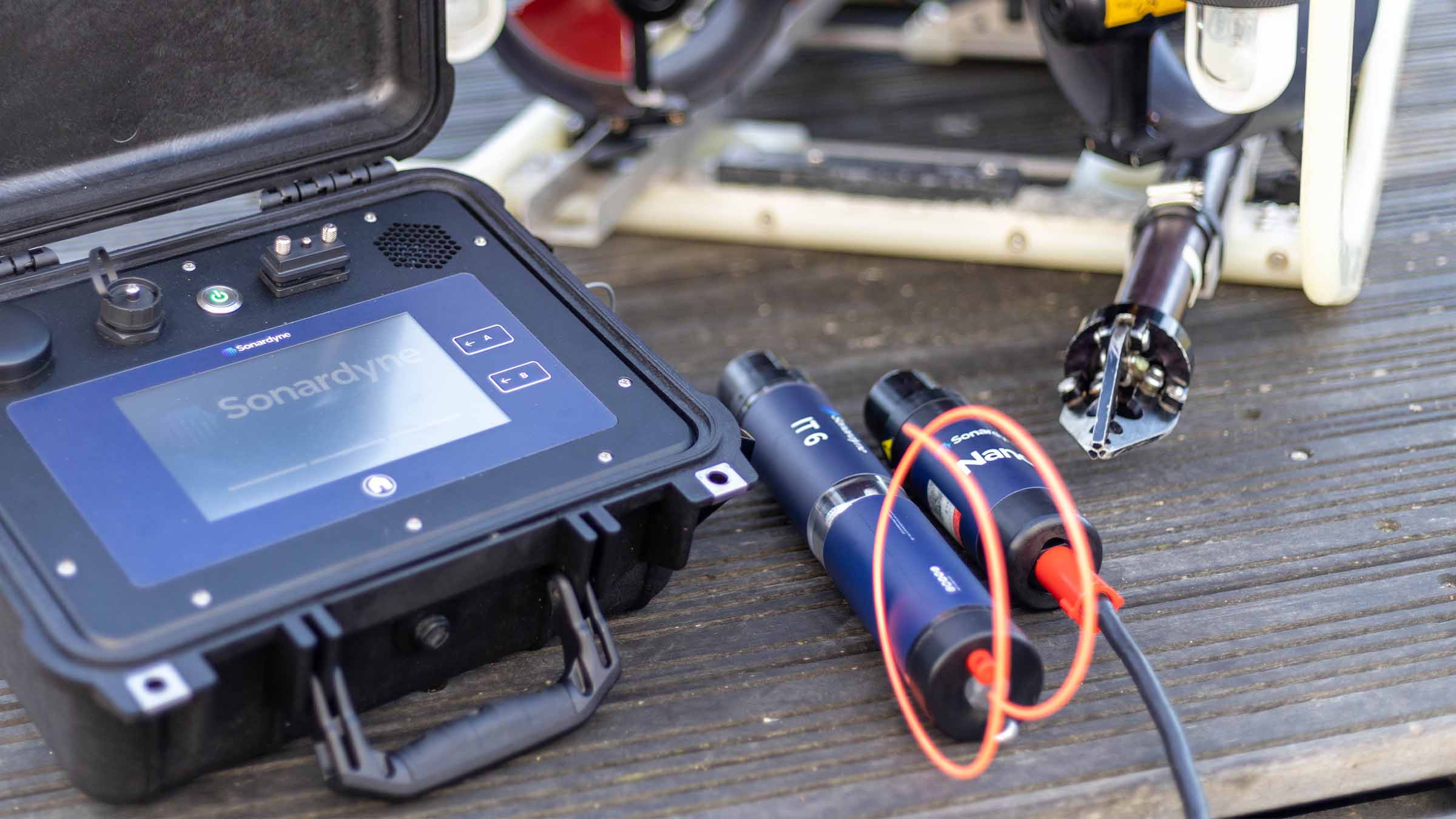
Initiation Transponder 6 (IT 6) is designed to be connected directly to a remotely deployed, non-electric (NONEL) mine neutralisation device, such as a Viper from ECS Special Projects. This allows commercial and naval EOD teams to send a wireless, acoustic command from their vessel to initiate a shock tube.
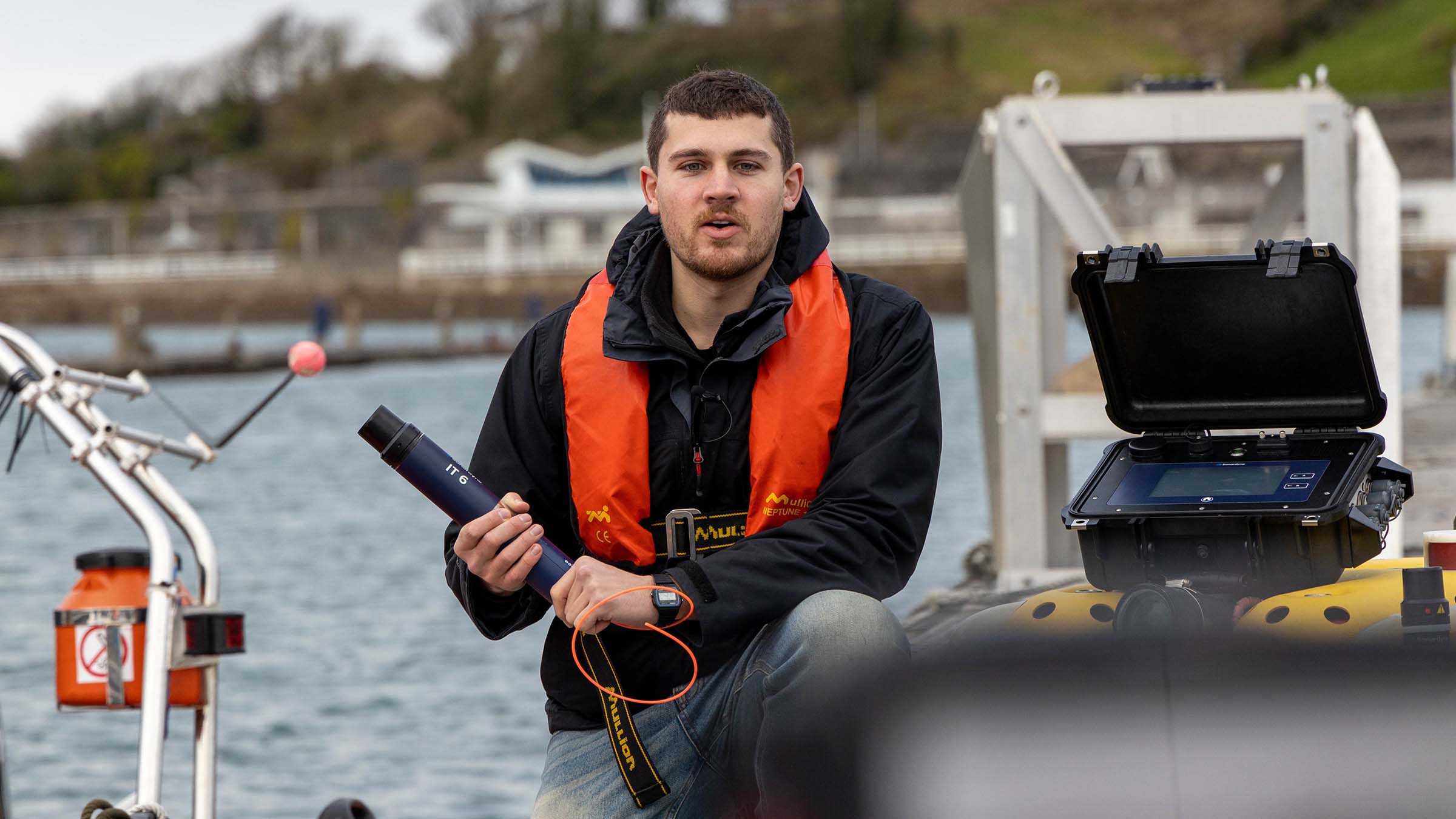
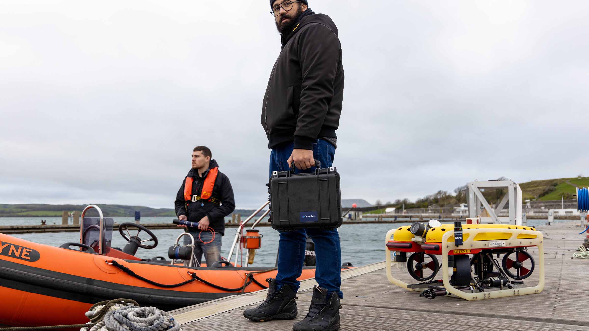
It can be placed directly by a clearance diver or remotely operated vehicles (ROV). Divers and ROVs are constrained by the equipment and payload they can carry so we’ve designed IT 6 to be small and lightweight yet tough enough to withstand everyday operational situations.
With use cases from offshore renewable energy to government and defence, IT 6 transponders are suitable for high order detonation and low order deflagration scenarios.
At a glance:
- Efficient, secure, safe
- 357 mm tall by 55 mm in diameter; 0.10 kg weight in water; designed to be carried by clearance divers or small ROVs
- Controlled using IP67-rated Deck Topside and cabled acoustic dunker
- Safe: automatic time-outs, hydrostatic switch, independent circuits for acoustics and firing
- Built using 6G hardware and Wideband 2 digital signal architecture: track with our Ranger 2 family of USBL tracking systems
The complete solution
Built for your UXO, MCM and EOD missions
Wireless
Underwater acoustic command and control is in our DNA, so IT 6 can be considered as reliable and as secure as traditional methods involving shock tubes and a lot safer than electrical detonation lines.
Safe
Safety and simplicity are key with the IT 6 and it features several fixed and user-configurable safety features.
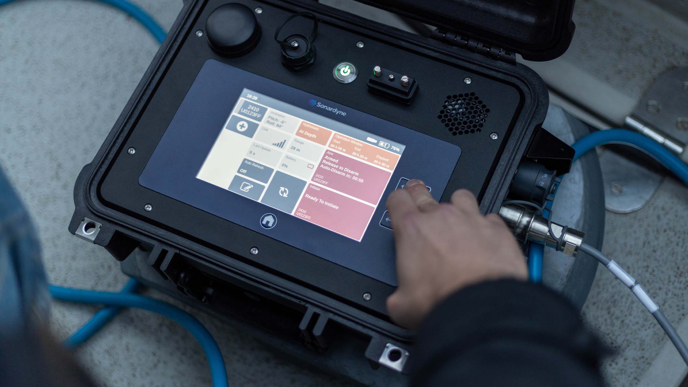
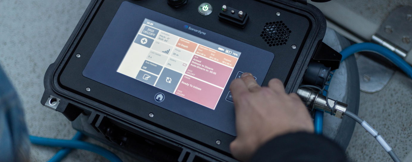
Firstly, the IT 6 comes complete with a hydrostatic switch, which means the unit cannot be put into an armed state when shallower than the fixed hydrostatic switch depth. If recovered back to deck, the IT 6 will also render itself impossible to arm when it goes below the minimum allowed depth.
Configurable off-deck delays and seabed timeouts mean fixed arming and firing windows can be set. The internal circuitry of the IT 6 also means that no power is applied to the independent detonation circuitry until the operator chooses to fire/initiate the NONEL output from the IT 6.
The clear housing on the IT 6 contains three status LEDs which allow the operator to quickly assess the state of the transponder and its safety. A magnetic ‘remove before use’ pin also means the IT 6 has a long operational battery life and can be powered down completely when not in use.
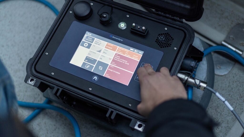
IT 6 is controlled using our field-proven Deck Topside system. Environmentally rated to IP67, the topside features a daylight readable 7-inch resistive touch screen, physical initiate/arm buttons and rechargeable battery – perfect for operating from small craft with no external power.
A further operational benefit of IT 6 is that its location can be tracked using any our Ranger 2 USBL systems which are installed on hundreds of energy, defence and science vessels globally.


General
• Wireless; replaces need for a hard-wired surface-to-seafloor connection
• Size and weight optimised, perfect for divers and small vehicles
• Low risk; engineered using COTS acoustic technologies in use globally
• Improves the efficiency and safety of improve the safety and efficiency of UXO, MCM and EOD operations
Ownership
• What’s in the box: IT 6
• Accessories: Float, pressure test kit
• Warranty: 1 year return to Sonardyne service centre
• ITAR Controlled: No
• UK Export Licence: Yes PL8001.a.3.
Performance
• MF operating frequency (20-34 kHz)
• Depth rated to 300 m
• Operating range > 1,000 m
• 11-pin Size-A CRE connectors x 2. Custom connectors on request
• Accepts 3 mm shock tube
• Alkaline battery
• 0 m, 2 m and 8 m hydrostatic switch options
Design
• 357 x 55 mm, 0.1 kg weight in water
• Acetal housing construction, clear
• Magnetic on/off switch
• External mounting point
• Integrated inclinometer for monitoring orientation
• High brightness internal status LEDs
• 262,144 unique addresses available
Specifications table
| Feature | Type 8373 | |
|---|---|---|
| Depth Rating | 300 m | |
| Operating Frequency | MF (23–31 kHz) | |
| Transducer Beam shape | Hemispherical | |
| Transmit Source Level (dB re 1 µPa @1 m) | 184 dB | |
| Operating Range | >1000 m | |
| Hydrostatic switch | 0 m, 2 m and 8 m options available | |
| Subsea status indicators | LEDs and acoustic communication | |
| Shock tube outer diameter accepted | 3 mm | |
| Operational Battery Life (Alkaline) | >45 days in not ready to arm state, >22.5 days in ready to arm state |
|
| Storage battery life | >3 years | |
| Repeat Firings with firing pin | >10 | |
| Mechanical Construction | Acetal | |
| Operating Temperature | -20 to 55ºC | |
| Storage Temperature | -20 to 55ºC | |
| Maximum Dimensions (Length x Diameter) | 357 x 55 mm | |
| Weight in Air/Water | 0.85 kg / 0.10 kg | |
| Export Status | Controlled under PL8001.a.3 | |
| Standards | UKCA |
STP files
Datasheets
Manuals and quick start guides
Did you know?
RT 6-6000 can be used with our Ranger 2 USBL family or Deck Topside
Overview
Ranger 2 – it's anything but standard
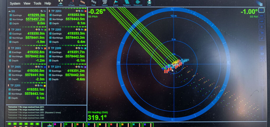
Ranger 2 is your complete subsea USBL workshop. Trace, track, command or position everything, in any depth, from any vessel, anything that your underwater operations may demand. Track a towfish, position an ROV, dynamically position your vessel, communicate with an AUV – or do all of this simultaneously.
What is possible
Ranger 2 comes with an impressive list of features including our award-winning 6G (sixth generation) acoustic hardware platform and Sonardyne Wideband 2 digital signal architecture. It provides stable and repeatable acoustic position referencing for your ship’s DP system, including those from GE, Kongsberg, MT, Navis, Thrustmaster and Wärtsilä.
As your needs grow and become more complex, bolt-on software packs unlock additional capability and protect your investment. Take the DP pack and enable your acoustic ranging to be aided by our inertial navigation technology (DP-INS). Add the robotics pack and commanding a swarm of up to 99 AUV’s is at your fingertips.
Ranger 2 can do even more, it also supports robust two-way data telemetry, allowing you to control our range of seafloor deployed, long-endurance sensors and recover your all-important data.
Track everything, in any depth, from any vessel
Why choose it?
- Tracks multiple targets to 11 km;
- Compatible with all makes of DP system – GE, Kongsberg, MT
- System accuracy: when fully optimised it will deliver 0.04% of slant range
- Works with a global inventory of pre-deployed Sonardyne 6G hardware
- Configurations available for USV and temporary vessel installations
- Valuable features included as standard
- Bolt-on packs available for growth with your operations and ambitions
- Developed and supported by a company with over 50 years of experience in innovative underwater technology
Learn more about Ranger 2 USBL
The kit
Transceivers
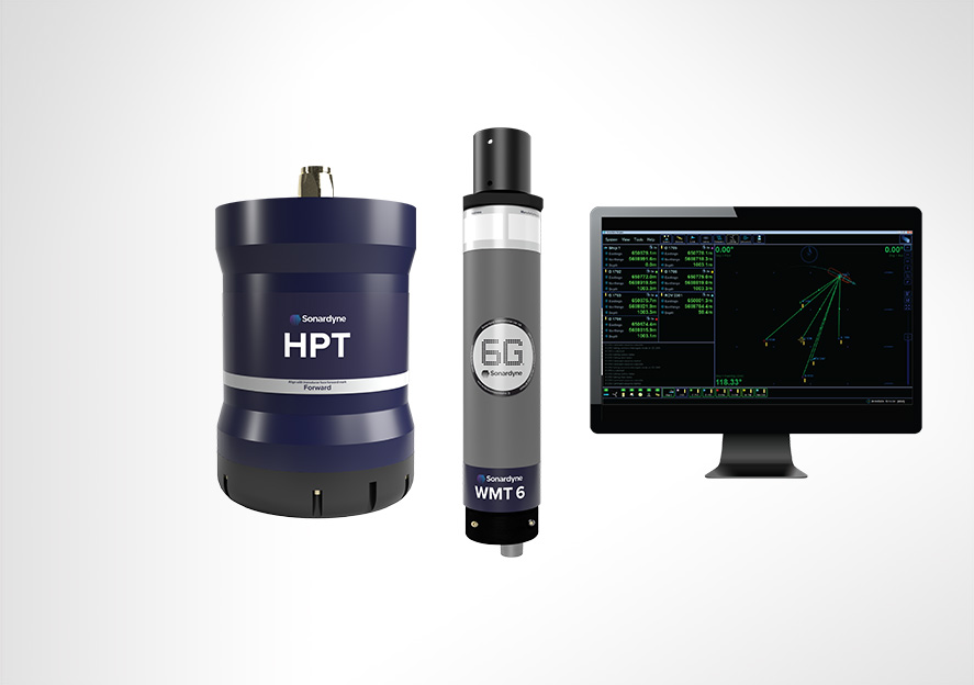
Our High Performance Transceiver (HPT), is available in a range of different designs to suit your operations whether they are in deep or shallow water or over a long layback.
HPT 5000 / 7000 are acoustic and telemetry transceivers designed for use with Ranger 2 USBL system. HPT 5000 enables targets offer wide range of water depths to be tracked; HPT 7000 is optimised for noisy DP drilling and construction vessels and in deep water.
HPT 5000 offers full hemispherical acoustic coverage so is a popular choice for tracking multiple targets (ROVs, AUVs, towfish, seafloor sensors) over a wide range of depths and elevations. The unit is also suitable for dynamic positioning reference on survey, research and offshore support vessels.
HPT 7000 is engineered for ultra-deepwater operations, tracking targets far below (rather than to the side of) a vessel, and for high vessel noise operating environments such as those typical of DP, drilling and construction where activity from thrusters is liable to cause signal interference.
If you need a solution for a vessel of opportunity, our pre-calibrated, all-in-one Gyro USBL transceiver is perfect. Lighter, smaller and just as capable, our second-generation Gyro USBL transceiver works seamlessly with Ranger 2 to track the position of your subsea targets from a USV, vessel of opportunity or from a pipelay vessel’s stinger over extreme ranges.
- All-in-one instrument; combined 6G acoustic transceiver and AHRS
- Choose between standard or ‘plus’ variants to suit your project’s specifications
- Optimises the performance of Ranger 2; eliminates lever arm offsets, pole bending and ship flexing errors
- Calibrated in-water before delivery – saving you time; install it and go to work
Transponders
The flexibility of the Ranger 2 family is further extended by our range of transponders to support a wide variety of your operations. WMT is a high-power transponder capable of operations to 7,000 m, while AvTrak 6 is our most capable acoustic vehicle instrument, combining the functions of a USBL transponder, LBL transceiver and modem for demanding applications such as AUV command and control.


Discover Ranger 2 in action
A new world of multi-robot ocean exploration
Read moreOptimising shallow water positioning for combined magnetometer and hydrographic surveys
Read moreLong-endurance AUV development with shallow water simplicity
Read morePerformance
• Up to 0.04% of slant range system accuracy
• Up 99 targets tracked, sequentially
• Up to 11,000 m tracking range (LMF)
• 1 Hz position update rate
• Supports all industry standard DP telegrams
• Supports acoustically aided INS
Acoustics
• MF frequency (20–34 kHz) or LMF (14-19.5 kHz)
• Compatible with a wide range of 6G transponders
• Supports Sonardyne Messaging Service for data exchange up to 9,000 bps
• Sonardyne Wideband 2 acoustics for reliable performance in both shallow and deep-water environments
Ownership
• ITAR Controlled: No
• Warranty: 1 year return to Sonardyne service centre
• UK Export Licence: Required
• What’s in the box: HPT 5000 / 7000 / Gyro USBL, deck cables, software, manual
Overview
• Can be used for both survey and construction phases
• Configurable to work in the LMF band enabling you to track targets to beyond 11 km
• Supports complex tracking scenarios such as structures and vehicles with multiple transponders and multiple remote offsets
Specifications table
| Feature | Specification |
|---|---|
| Design | The most powerful USBL system on the market |
| Incorporates 30 years of USBL innovation and know-how | |
| Recommended for installation on large vessels and USVs | |
| Global vessel track record; offshore, research, cable-lay, salvage and naval | |
| Shares common platform with other Sonardyne USBLs | |
| Performance | Up to 0.04% of slant range system accuracy |
| Up to 99 targets tracked, simultaneously | |
| Up to 11,000 m tracking range (LMF) | |
| 1 Hz position update rate | |
| Support all industry standard DP telegrams | |
| Supports acoustically-aided INS | |
| Acoustics | MF frequency (20-34 kHz) or LMF (14-19.5 kHz) |
| Sonardyne Wideband 2 digital acoustics for reliable performance in both shallow and deep environments | |
| Supports Sonardyne Messaging Service for data exchange up to 9,000 bps | |
| Compatible with a wide range of 6G transponders |